
Chapter 5. How the site Your Land History fits with this guide
As the preface tells, the survey notes and maps for the tree farm near Pedee were gathered by computer in a single day in October 2026, and the old aerial photographs soon after. The website Your Land History, at YourLandHistory.org, grew out of that work. For any piece of Oregon land, it does the part of the research a computer can do on request, and it writes what it finds in plain English.
What the site does
You start on the front page by saying where your land is: by township, range and section; by county and tax lot; or by street address. If you have none of those, you can find the land on a map (Figure 5.1). The site then gathers the records it can fetch on your behalf, among them the federal survey plats, field notes and patents for your township; the geology, soils, elevation and streams; rainfall and temperature since 1895; topographic maps; and modern aerial photographs. It assembles them into a report that opens with the land as it is today and then tells its story in order, in the layers listed in Chapter 1. The record behind every paragraph is one click away. Anyone with a report's link can open it, and nobody can find it without the link.
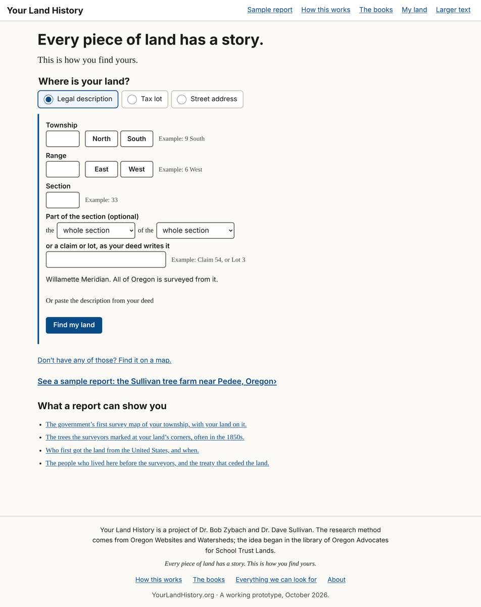
Figure 5.1. The front page of Your Land History. The page asks one question, "Where is your land?", and offers three ways to answer it: a legal description, a county and tax lot or account number, or a street address. For anyone who has none of those, a map is offered just below. YourLandHistory.org, version 1.1, October 2026.
What the site cannot do
Much of a land's history cannot be fetched by a computer. The county deed books before the online index begins, the files behind the patents at the National Archives, most of the old aerial photographs, estate files, family papers, the walk on the ground and the memories of people who know the place all need a person. Some records the site does fetch, such as handwritten survey notes, still need a person to read them closely. And every history needs judgment that no search can supply: which record to trust when two disagree, and how sure to be.
Using the two together
Start with the site, and let it do the first evenings of gathering. Then use this guide in two ways. Use it to understand what the site hands you: what a plat is, how to read a bearing tree, why a patent is not today's title. And use it to go after everything the site cannot fetch. Near its end, every report on the site has a section called "If you're hooked: what to do next." Chapter 24 of this guide is the long version. A companion book, Your Land History: The User's Manual, explains every screen of the site.
On the tree farm
The site's public sample report is the same farm, the Sullivan tree farm near Pedee, with its sections in the order Chapter 1 describes. What the site cannot do for the farm is the farm's own list of next steps: trace the deeds from the patents of 1877 to the sale of 1989; read the claimants' sworn statements in the donation land claim files; order the homesteader's case file from the National Archives; look at the 1934 drawings of the John Johnson house at Pedee; walk the old corners and house sites with the survey notes in hand; and talk to the people who know the place.1 That list is the work of the rest of this guide.
Notes
- A History of the Land (2026), "Researching your own land's history" (step 9) and "Next steps for this property."