
Chapter 20. Following change through time: roads, railroads and land use
In 1912 the Cobbs and Mitchell lumber company incorporated the Valley and Siletz Railroad to carry logs and lumber between Valsetz, a timber town in the Coast Range, and Independence, on the Willamette River. Its track followed the Luckiamute River down past Pedee (Figure 20.1).1 For more than sixty years it carried the forests of the upper Luckiamute to market. Most of the line was abandoned in 1978, and its last owner, Boise Cascade, took up the section through Hoskins early in 1979.2
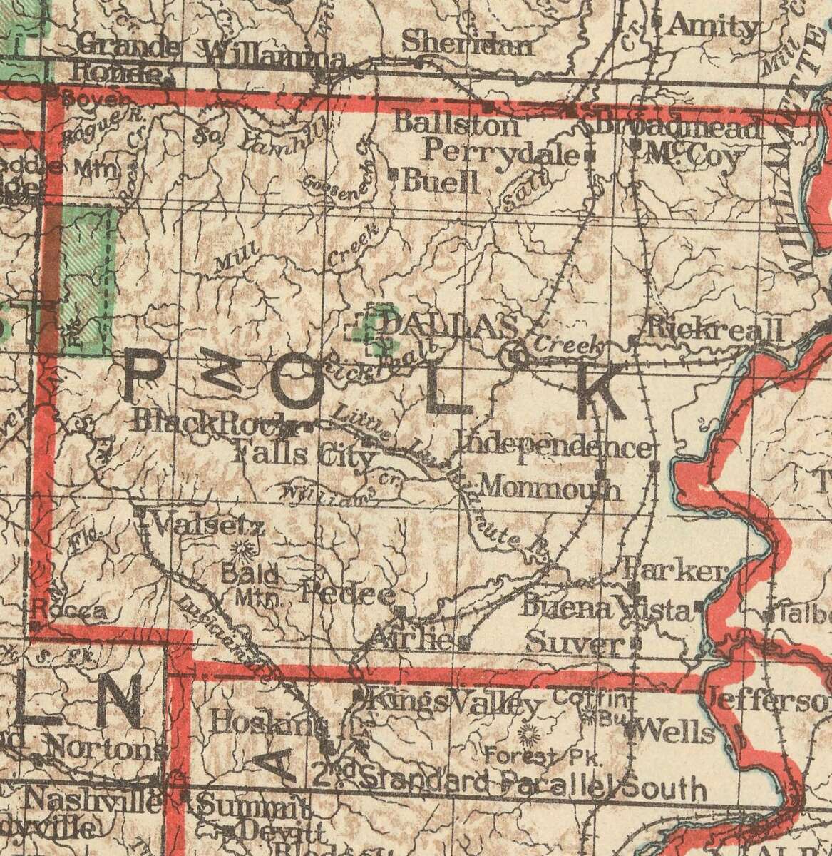
Figure 20.1. Polk County on the General Land Office map of Oregon, 1922. Find Pedee, then follow the railroad, drawn as a line crossed by short ticks, up the Luckiamute to Valsetz, and the branch that ends at Airlie. A state map like this one can date a route even when the histories disagree. U.S. General Land Office, State of Oregon, 1922 (detail). Scan: David Rumsey Map Collection, CC BY-NC-SA 3.0.
Many of the biggest changes on a piece of land were caused by something that happened miles away. A railroad arrived, a highway moved, a mill closed, a power line came through. The ground stayed the same, but what it could earn did not.
Roads, rails and wires arrive in order
In the West the usual order was trail, wagon road, railroad, then automobile highway. Mail delivery, the telephone and electric power followed, each on its own date. Each one changed what could leave a farm or a forest at a profit, and so what the land was used for. A logging railroad could turn standing timber miles up a valley into lumber that could be sold (Figure 20.2). To date a change on your land, find the dates of the roads and rails that served it.
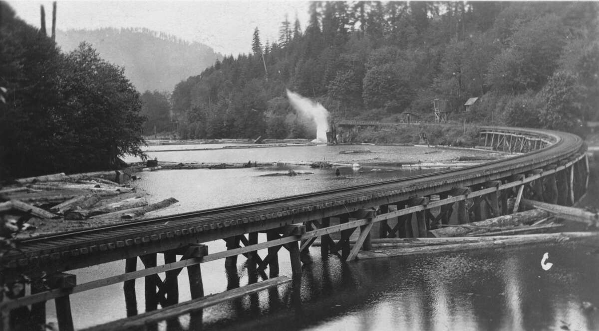
Figure 20.2. The Valley and Siletz Railroad on a trestle beside a log pond. Logs float in the pond along the track. A line like this one carried the forest out of the upper Luckiamute for more than sixty years. Undated postcard. Gerald W. Williams Collection, Special Collections and Archives Research Center, Oregon State University Libraries. No known copyright restrictions.
Where the dates are kept
- The first survey plats show the trails and wagon roads of the 1850s (Chapter 11).
- Each edition of the U.S. Geological Survey's topographic maps, maps that show the shape of the land with contour lines, shows the roads and railroads of its year (Chapter 11).
- The Library of Congress has a free online collection of railroad maps from 1828 to 1900.3
- State highway departments published maps and reports year by year.
- County road records are kept by the county surveyor or road department, and the Oregon State Archives' county inventories list the older ones (Chapter 25).
- Newspapers give the dates of openings, closings and wrecks (Chapter 9).
- Old bridges and road grades are dated records of a route themselves (Figure 20.3).
A map can also fix a date when the histories disagree. Oregon State University's history of Hoskins says the Valley and Siletz was finished in 1914, while state railroad reports of 1915 and 1917 describe it still growing. The General Land Office's map of 1922 settles the part that matters for most questions: by 1922 the line ran all the way to Valsetz.4
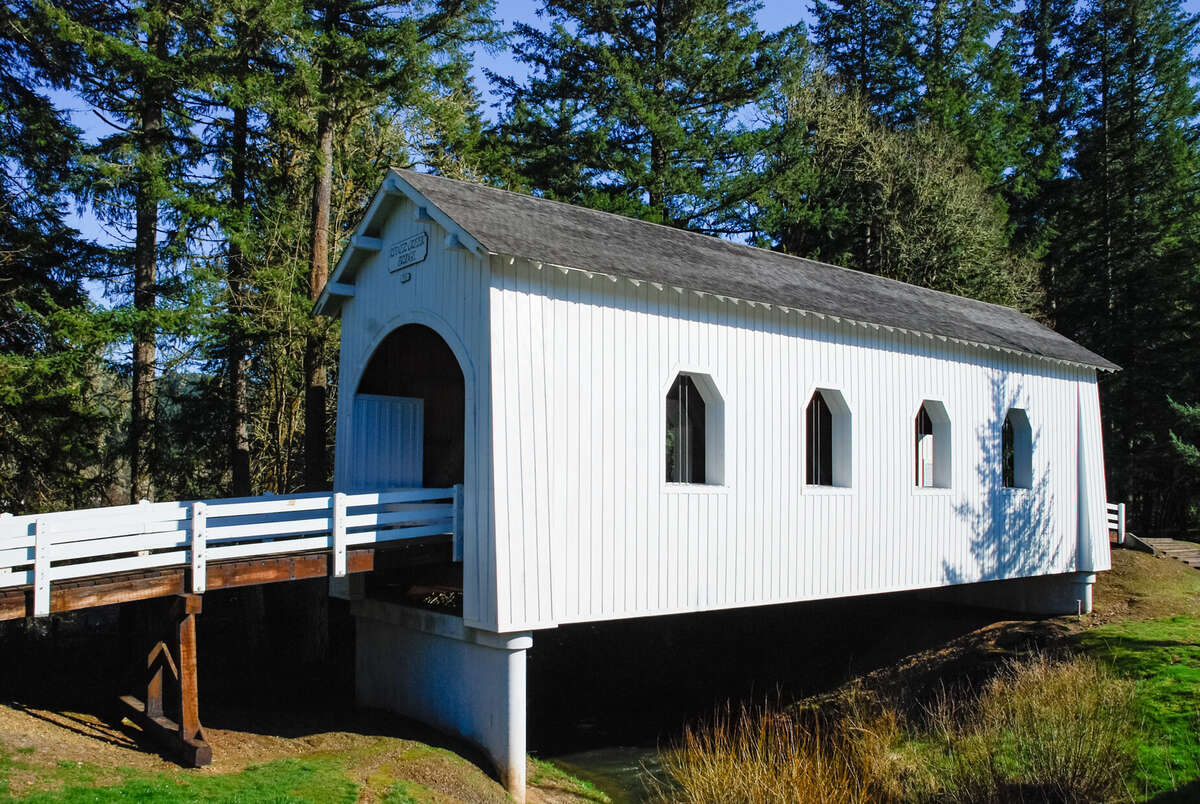
Figure 20.3. The Ritner Creek covered bridge, 2010. Built in 1927 to carry the Kings Valley Highway over Ritner Creek, the bridge was moved just downstream in 1976. Old roads and bridges date the routes that tied farms to their markets. Gary Halvorson, Oregon State Archives, 2010. CC BY 4.0.
Land use and industry
The second kind of change is in how the land was used: farming, grazing, logging, milling, mining or housing, and when one use gave way to another. The Annual National Land Cover Database maps the land cover of the lower 48 states for every year from 1985 to 2025, so you can watch a field become a forest, or a forest become a subdivision (Figure 20.4).5 County planning offices keep zoning maps and their history. The Forest History Society collects the records and photographs of logging and lumber companies. For past industrial uses that may have left something in the ground, the Environmental Protection Agency's "Cleanups in My Community" and Oregon's Department of Environmental Quality list known sites, and the Oregon Department of Geology and Mineral Industries maps old mines and quarries.
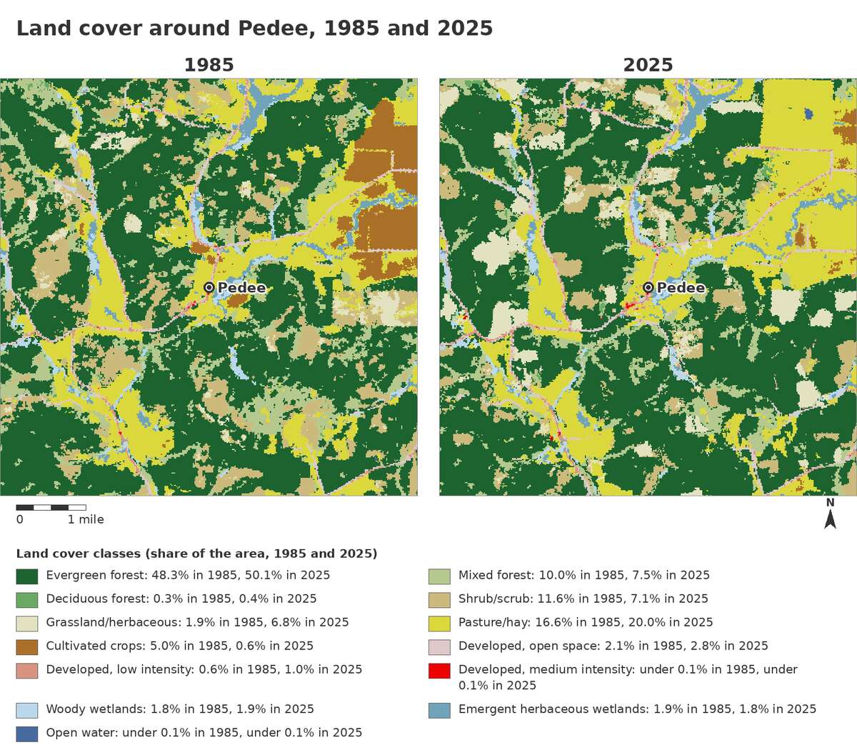
Figure 20.4. Land cover around Pedee, 1985 and 2025. The same 6-mile square in both years, with Pedee at the center. Watch the brown cropland east of Pedee all but disappear, and the patches of forest and shrub shift as stands are cut and grow back. U.S. Geological Survey and the Multi-Resolution Land Characteristics Consortium, Annual National Land Cover Database, 1985 and 2025, retrieved October 7, 2026. Drawn for this guide.
On the tree farm
A narrow-gauge railroad reached the farm's neighborhood only 26 years after the land claims were surveyed. William Reid's Oregonian Railway reached Airlie, just southeast of Pedee, in September 1881, and its line from Airlie north to Monmouth was abandoned in 1927.6 The Valley and Siletz followed the river past the farm, and the earliest aerial photograph of the farm, taken in 1936, shows its track running toward Pedee.7 On the Kings Valley Highway near Pedee, the Ritner Creek covered bridge was built in 1927. In 1976 it was lifted from its foundation and moved just downstream (Figure 20.3).8 Since 1985 the change has been in the land cover. In the 6-mile square around Pedee, cultivated crops covered about 5 percent of the ground in 1985 and less than 1 percent in 2025. Pasture and hay grew from about 17 to 20 percent, and evergreen forest covered about half in both years (Figure 20.4).9
Notes
- Oregon State University Libraries, Special Collections and Archives Research Center, "Local History in the Special Collections and Archives Research Center: Hoskins," historical sketch, checked October 10, 2026; A History of the Land (2026), "The twentieth century, seen from the air."
- "Valley and Siletz Railroad," Wikipedia, checked October 10, 2026, citing Benton County's Fort Hoskins Historic Park brochure for the 1978 abandonment; OSU, "Local History: Hoskins," for Boise Cascade and the removal of the Hoskins section in early 1979.
- Library of Congress, "Railroad Maps, 1828 to 1900," online collection, loc.gov.
- OSU, "Local History: Hoskins" (finished 1914); the Eighth Annual Report of the Railroad Commission of Oregon (1915) and the Tenth Annual Report of the Public Service Commission of Oregon (1917), as summarized in "Valley and Siletz Railroad," Wikipedia, checked October 10, 2026; U.S. General Land Office, State of Oregon (1922), David Rumsey Map Collection.
- U.S. Geological Survey and Multi-Resolution Land Characteristics Consortium, Annual National Land Cover Database, mrlc.gov, years 1985 to 2025.
- Richard Engeman, "Community of Airlie (Benton County)," The Oregon Encyclopedia, last updated February 24, 2022; Airlie's place on the 1922 General Land Office map of Oregon (Figure 20.1).
- A History of the Land (2026), "The twentieth century, seen from the air."
- "Ritner Creek Bridge," Wikipedia, checked October 10, 2026, citing Polk County's page on the bridge; National Register of Historic Places, Ritner Creek Bridge, listed November 29, 1979.
- Annual National Land Cover Database, 1985 and 2025, shares of the 6-mile square around Pedee as counted for Figure 20.4.