
Chapter 1. Finding your land three ways
Part 1. Making your report.
Making a report takes three steps: say where your land is, check the outline the site draws, and let the site gather and write. You type a few numbers and answer one question. The rest is reading.
Start here: five steps
- Go to the site. Open the web browser on your phone, tablet or computer, type YourLandHistory.org in the bar at the top, and press Enter or Go.
- Have one thing in hand. Your property tax statement is best; your deed also works. With neither, you can find your land on a map.
- Choose one of the three ways in under "Where is your land?": Legal description, Tax lot or Street address. For the sample farm you would touch Tax lot, choose Polk from the county list, type the map number 9S 6W 33 and the four tax lots 200, 206, 207, 304, and touch Find my land.
- Check the outline. The next page shows the land outlined in yellow on an air photo and asks "Is this your land?" If it is, touch Yes, make my report.
- Read as it arrives. The report starts at once, and each part appears as soon as it is written. The area history made for this manual took about two minutes; a township's first report takes longer. You can leave and come back with the report's link.
The quickest way to find a piece of Oregon land is the way the government first described it in the 1850s: by township, range and section, on the grid of squares the surveyors laid over the whole state. The front page asks for those numbers first, and offers two other ways in for anyone who does not have them.
The front page
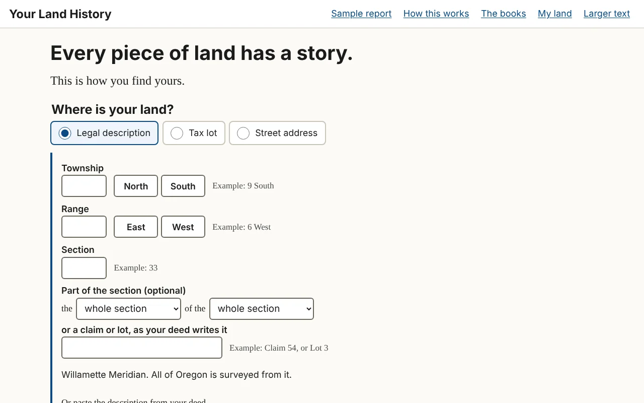
The front page asks one question: "Where is your land?" Its heading reads "Every piece of land has a story. This is how you find yours."
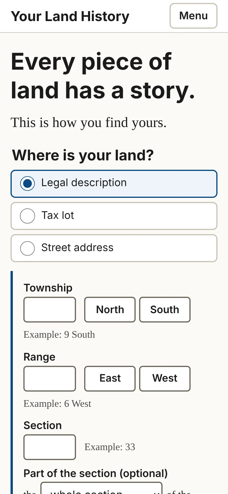
Under the question are three choices: Legal description, Tax lot and Street address. On a wide screen they are tabs across the top of a box; on a phone they are stacked buttons, and the one you choose opens beneath itself. Legal description is open when the page arrives.
Below the box are:
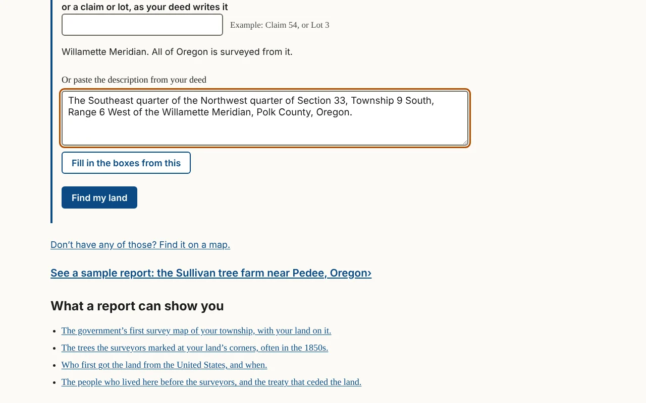
- a line that reads Don't have any of those? Find it on a map., for anyone without numbers;
- a link to the finished sample report, See a sample report: the Sullivan tree farm near Pedee, Oregon;
- four lines under the heading "What a report can show you," each a link to the part of the sample that shows it: the government's first survey map of your township, the trees the surveyors marked at your land's corners, who first got the land from the United States, and the people who lived there before the surveyors;
- under them, See everything a report can look for ›, which opens the full menu of topics (Chapter 20).
The header at the top of every page holds Your Land History (back to the front page), Sample report, How this works, The books, My land and Larger text. On a phone it shrinks to the site's name and a Menu button; touch Menu for the same links, Larger text among them. The foot of every page names the people behind the site and links to How this works, The books, Everything we can look for and About.
Three of those pages are about the site itself. How this works opens with the cedar post that surveyors set on a ridge west of Portland on June 4, 1851, from which every township in Oregon and Washington is counted, and then lists the five steps by which a report is made. The books offers this manual and Knowing Your Land, both free to read on the site. About says who is behind Your Land History and why the sample is a tree farm near Pedee, and gives the address for corrections, additions and questions: drdavesullivan@gmail.com.
Way one: the legal description
A legal description names land by its place on the survey grid. Read it from the end back: "The SE¼ of the NW¼ of Section 33, Township 9 South, Range 6 West" means the township, then Section 33, then its northwest quarter, then the southeast quarter of that. The box has these parts.
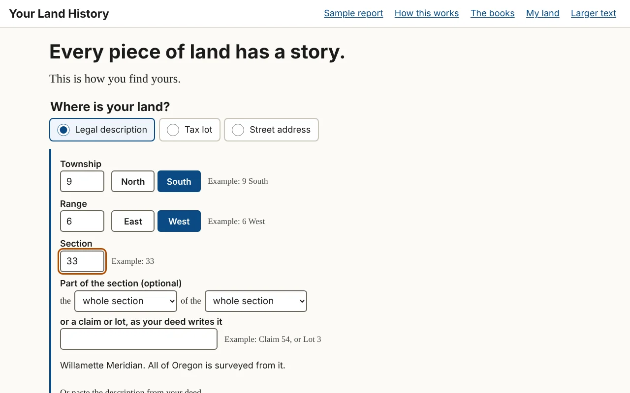
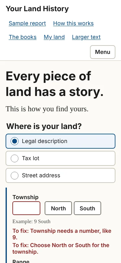
- Township. Type the number, then touch North or South. Example: 9 South. A township is a block of land six miles on a side; "9 South" is the ninth row of blocks south of the base line that crosses Oregon at Portland.
- Range. Type the number, then touch East or West. Example: 6 West. A range is a column of townships, counted from the Willamette Meridian, the north-south line through Portland.
- Section. Type a number from 1 to 36. Example: 33. Each township holds 36 sections, each about a mile square, or 640 acres.
- Part of the section (optional). Two drop-down lists that read as a phrase, "the [ ] of the [ ]," each offering the whole section or one of its four quarters. Choose only the second for a quarter section of 160 acres; choose both for a quarter of a quarter, 40 acres. For the description above, choose "southeast quarter," then "northwest quarter."
- or a claim or lot, as your deed writes it. A text box for land described by a pioneer's land claim or a numbered lot instead of quarters. Example: Claim 54, or Lot 3.
Under the boxes is one plain line: "Willamette Meridian. All of Oregon is surveyed from it." There is no choice of state or meridian to make.
If your deed's description is hard to break apart, use Or paste the description from your deed, a link under the boxes. Paste or type the deed's words into the box it opens, then touch Fill in the boxes from this. The site fills in what it can find, keeps your words beside the boxes, and says "We filled in the boxes from what you pasted. Please check each one." Check them.
When the boxes are filled, touch Find my land.
On a phone, the number boxes bring up the number keypad, and North, South, East and West are large buttons, so you never type a letter.
In the sample report
The Sullivan tree farm lies in Sections 28 and 33 of Township 9 South, Range 6 West. To find its main section, you would type 9 and touch South, type 6 and touch West, and type 33. Typing "Claim 54" in the claim box instead would outline the whole of Donation Land Claim 54, one of the two 1850s land claims the sample names.1
Way two: the tax lot
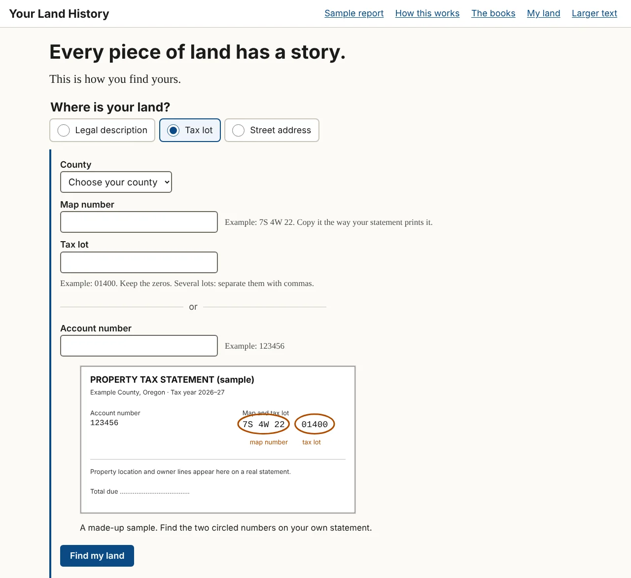
Every Oregon tax statement prints the numbers this box needs.
- County. A list of Oregon's 36 counties. Choose yours.
- Map number. Example: 7S 4W 22. Copy it the way your statement prints it.
- Tax lot. Example: 01400. Keep the zeros. Several lots: separate them with commas.
- a divider line reading "or"
- Account number. Example: 123456.
Give the map number and the tax lot. The account number is not used yet: given by itself, it brings the answer "We can't look up land by account number yet. Use the map number and tax lot printed on the same statement, or your legal description." A small sample statement beside the boxes shows where the numbers are printed.
Reading a map number. An Oregon tax map number is built from the survey grid. The sample farm's map number, "9S 6W 33," means Township 9 South, Range 6 West, Section 33. Letters after the section number name a quarter of the section. Some statements print the number without spaces, as "09S06W33." Copy it as printed, letters and all.
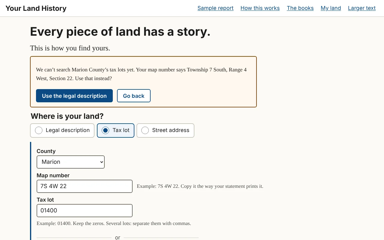
If the site can search your county's tax lots, it draws the lots' own outline for you to check. In this version that is Polk County. For other counties it reads the township, range and section out of your map number and offers them instead:
"We can't search [county] County's tax lots yet. Your map number says Township [number] [North or South], Range [number] [East or West], Section [number]. Use that instead?"
Touch Use the legal description to go on with those numbers, or Go back to change what you typed. The report will cover the whole section, which includes your lot (Chapter 2).
In the sample report
The sample was made this way: county, Polk; map number, 9S 6W 33; tax lots, "200, 206, 207, 304," the farm's four lots. They were typed without leading zeros, and the site still found them; copy yours as your statement prints them.2
Way three: the street address
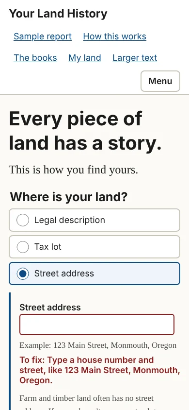
The Street address box has one line. Type a house number and street, like "123 Main Street, Monmouth, Oregon." Under it is a warning worth reading: "Farm and timber land often has no street address. If yours doesn't, use your tax lot."
The site looks the address up in the Census Bureau's address list. If there are several matches, the page asks "Which one is yours?" and shows up to eight as buttons. An address finds a point, not a lot, so the report it makes is an area history: the history of the land around that point. To get your own lot, use your tax lot.
The address you type is never printed on the report and never becomes its name. Such a report is named "Land in [county] County," and you can rename it.
No numbers at all: find it on a map
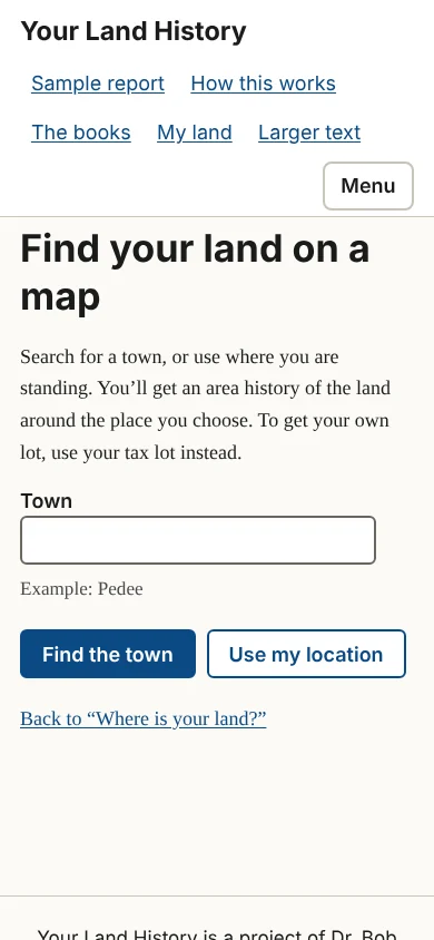
Touch Don't have any of those? Find it on a map. to open "Find your land on a map." There are two ways to use it.
- Type a town into the Town box and touch Find the town. Up to eight matches appear as buttons. Choose one.
- Touch Use my location, and let your browser tell the site where you are. This is the easiest way in if you are standing on the land with a phone. The button appears only where the browser offers it.
Either way you get an area history of the land around that place. To get your own lot, use your tax lot instead.
When something you typed needs fixing
If a box is empty or a number cannot be right, a short message beginning "To fix:" appears next to that box (Figure 1.9). Nothing you typed is cleared. Chapter 25 lists every message, word for word, with what to do.
When your township is new to the site
The first search in a township takes longer, because the site fetches the township's survey grid; later searches there are faster. If the site cannot make a report in that township yet, it says: "We can't make a report in Township [number] [North or South], Range [number] [East or West] yet. Its survey records have not been gathered. The sample report shows what a report holds." Chapter 25 says what to do.
The sample report
See a sample report: the Sullivan tree farm near Pedee, Oregon, on the front page, and Sample report, in the header, both open the finished sample. Opening it builds nothing and changes nothing. Part 2 walks through it.
Notes
- A History of the Land: The Story of the Sullivan Tree Farm near Pedee, Polk County, Oregon (October 2026), "The land today" and "1855: Two claims and two houses"; Partition Plat No. 1993-0029, June 24, 1993, Polk County survey CS 12769. ↩
- The sample report, made October 10, 2026, from Polk County map 9.6.33, tax lots 200, 206, 207 and 304; A History of the Land (2026), "December 1989 to today," which names the farm's lots. ↩