
Chapter 2. Checking the outline
Part 1. Making your report.
The next screen asks one question, in large type: "Is this your land?" It is the only thing between your numbers and your report, and it is worth a careful look, because the report will be about whatever the outline encloses.
What the screen shows
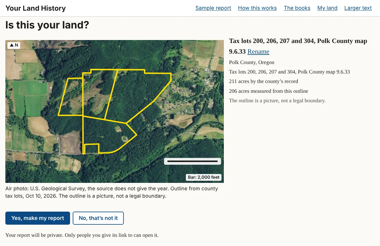
The picture is an air photo with an outline in yellow, a north arrow and a scale bar, and a line naming the photo's source and year. Beside it are:
- the name the report will carry, with Rename beside it;
- the county and state;
- the legal description, written out in full words (for tax lots, the lot numbers and the county's map number);
- the acres, shown two ways when both are known: "by the county's record" and "measured from this outline."
If the two acre figures differ by more than a tenth, one more line explains: "The two figures differ by [number] acres. Old surveys and modern maps rarely agree exactly; the county's figure is the one on your tax statement." A reminder follows: "The outline is a picture, not a legal boundary."
How to check it
Look for something you know: a road, a creek, a field edge, a clearing. Follow the yellow line around and ask whether it goes where your fence or your tax map says it should. Compare the acres with your tax statement. A few acres' difference is normal; half, or an outline on the wrong side of the creek, is not.
In the sample report
For the Sullivan tree farm the screen reads "211 acres by the county's record" and "206 acres measured from this outline." Neither figure is wrong. One is the county's record for taxes; the other is a measurement of lines drawn on a map. That is why the site shows both and says where each comes from.1
The two answers
- Yes, make my report starts the report at once and takes you to it.
- No, that's not it takes you back to the front page with every box as you left it, except a street address, which the site never keeps.
Under the buttons is one line about privacy: "Your report will be private. Only people you give its link to can open it."
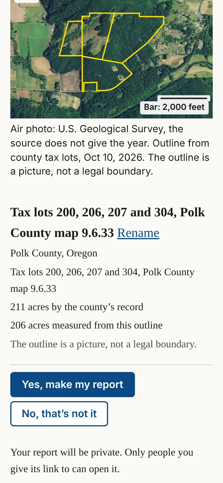
On a phone the buttons stay at the bottom of the screen, with Yes, make my report on top.
Naming the report
Touch Rename to open a box with the current name and a Save button. Choose a name you will recognize later in My land. Until you change it, a report made from a legal description is named for its square, such as "Section 33, Township 9 South, Range 6 West, Willamette Meridian"; one made from a tax lot is named for its lots and map, such as "Tax lots 200, 206, 207 and 304, Polk County map 9.6.33"; and one made from an address is named "Land in [county] County." The sample is named "The Sullivan tree farm near Pedee."
When the site can only find the square mile
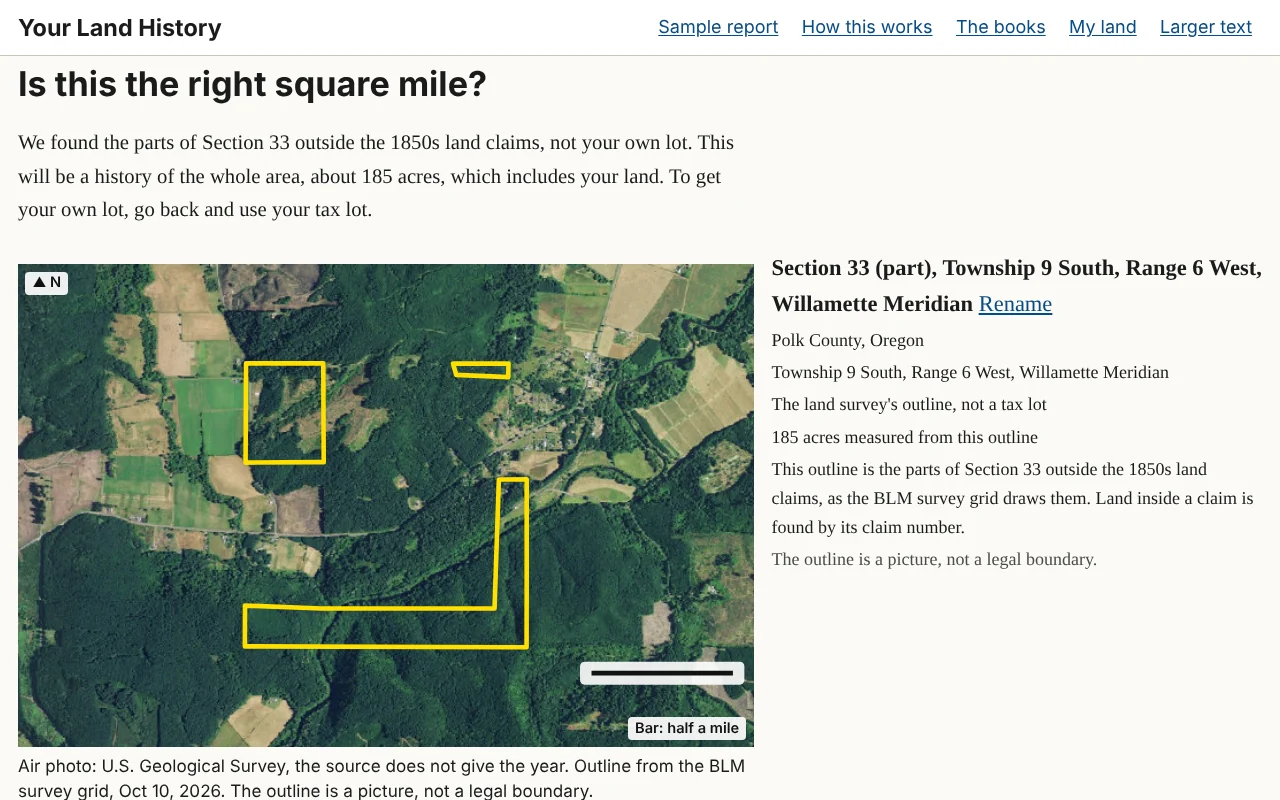
When the site can find the section but not your piece of it, or you came in by address or map, the heading becomes "Is this the right square mile?" and a paragraph says what the report will cover:
"We found Section [number], not your own lot. This will be a history of the whole area, about [number] acres, which includes your land. To get your own lot, go back and use your tax lot."
Where part of the section lies inside 1850s land claims, the site outlines only the parts outside the claims, and the paragraph begins "We found the parts of Section [number] outside the 1850s land claims." A line beside the picture adds: "Land inside a claim is found by its claim number." To make a report on a claim itself, go back and type its number in the claim box.
For a street address or a place on the map, the first sentence reads "We found the place, not your lot. This will be a history of the land around it, about [number] acres."
The buttons become Yes, make the area history and No, that's not it.
An area history is often nearly as good as a report on your own lot, because much of the early record was made section by section anyway. What it cannot do is say which part of the section is yours, and its first owners will include everyone who got land in that square mile.
Land outside Oregon
Washington is surveyed from the same meridian as Oregon, so a slip in the township number, or North chosen for South, can put the outline across the Columbia River. If the outline on "Is this your land?" is not where your land is, touch No, that's not it and check the township, the range and the North or South and East or West choices.
Notes
- The sample report, "This land today," October 10, 2026, from Polk County tax lots. ↩