
Chapter 4. The four studies behind the approach
On June 29, 1948, an airplane photographed the town of Alsea, in the Oregon Coast Range. The photograph is crossed by long straight lines: roads, fences and field edges. Many of them follow the section lines and land claim lines that surveyors ran across the valley in the early 1850s, still plain to see a century later (Figure 4.1).1 A straight edge in the trees usually has a reason. Finding the reason is the kind of work this guide teaches.
The approach in this guide comes from four studies by Bob Zybach. Each one shows one part of the work especially well. They covered whole valleys and a mountain range; this guide applies the same habits to a single property. All four are free to read online, and the notes give the addresses.
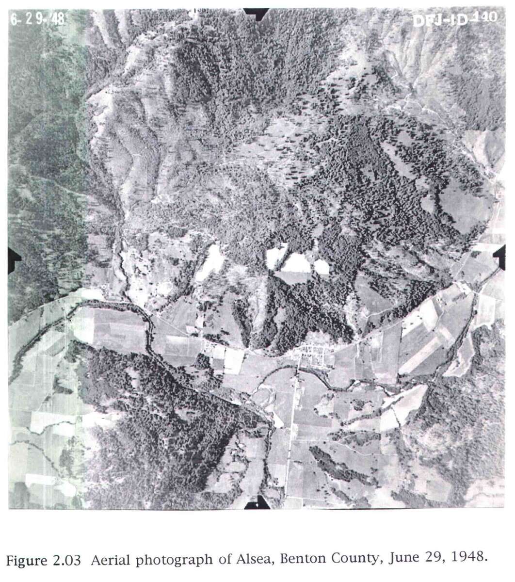
Figure 4.1. Alsea from the air, June 29, 1948. Look for the long straight lines of roads, fences and field edges. Many follow section lines and land claim lines of the early 1850s, still visible a century later. From Bob Zybach, The Great Fires (2003), Figure 2.03. Photograph courtesy of the University of Oregon Knight Library.
Oral histories: Soap Creek Valley, 1999
Using Oral Histories to Document Changing Forest Cover Patterns: Soap Creek Valley, Oregon, 1500-1999 was a master's thesis at Oregon State University about a valley north of Corvallis. It was built on recorded interviews. The people chosen had first-hand knowledge of the valley and had lived or worked there a long time, and the oldest were interviewed first whenever possible. Interviews were often held at the places where events had happened, with maps, aerial photographs and old objects on hand to prompt memory. When those memories were tested against documents, the study found, in most instances, "striking degrees of consistency in detail."2 It is the model for Chapter 18, on interviews. Start with pages 18 to 62.
Maps and surveys: Coquelle Trails, 2013
Coquelle Trails: Early Historical Roads and Trails of Ancestral Coquille Indian Lands, 1826-1875, written with Don Ivy for the Coquille Indian Tribe, set out "to locate and document, so near as possible, the exact locations of the earliest historical trails, named landmarks, private landowners, and important events."3 Near Port Orford the authors compared an 1875 township survey map, a geological map of the 1890s and a 1941 ownership map of the same ground. All three are drawn on the same survey lines, so they line up. On their own maps the authors drew roads and trails that still exist as solid lines, and routes that were predicted, or documented but no longer mapped, as dotted lines. Then they went to look, and visited about 80 percent of the study area.4 It is the model for Chapter 11, on maps. Start with Volume I, Part 1, pages 7 to 16.
Land-based evidence: Tiller, 2011
The Tiller Pre-Contact Reference Condition Study set out to describe the forest of the South Umpqua headwaters as it stood 200 years ago. Its four overlapping steps were "archival research and literature review, predictive field map construction, 'ground-truthing' the predictive map (field research), and synthesis."5 From the records, Zybach marked where old ridgeline trails met and where camps and springs were named, as likely places to find stone tools or plants that people had tended. Then he visited them. The report says such evidence "was readily found at each of these exact locations."6 It is the model for Chapter 17, on reading the ground. Start with Chapter II, pages 8 to 37.
All four kinds of evidence together: The Great Fires, 2003
The Great Fires: Indian Burning and Catastrophic Forest Fire Patterns of the Oregon Coast Range, 1491-1951, a doctoral dissertation at Oregon State University, weighed travelers' journals, survey notes, maps, photographs and living memory across a whole mountain range. Its rule is the rule of this guide: "research questions are answered based on the 'weight of evidence' from multiple sources."7 It is the model for Chapters 19 and 21, on putting the pieces together. Start with Chapter 2, from page 52.
What the four have in common
Each study checked one kind of evidence against another: maps against the ground, memories against documents, journals against surveys. Each went outdoors or to the people. And each said plainly what was known, what was inferred, and what was not yet known. Those habits are the method of this guide.
On the tree farm
The Soap Creek study reaches into the farm's own history. Its appendix lists 45 people by name from the Grand Ronde reservation census rolls of 1860 and 1888. Twenty-seven appear under the heading "Chapanafa Nation," which the study explains as the Marys River people, and 18 under "Luckymute Nation," the Luckiamute, the people of the river that runs past Pedee.8 With the Luckiamute leaders who signed the treaty of 1855 (Chapter 16), those names are as close as the records yet come to the people who lived along this stretch of the river before 1856. No record found so far ties a named person to the farm itself.
Notes
- Bob Zybach, The Great Fires: Indian Burning and Catastrophic Forest Fire Patterns of the Oregon Coast Range, 1491-1951 (PhD dissertation, Oregon State University, 2003), Figure 2.03. Online at ir.library.oregonstate.edu/downloads/5x21tj35x.
- Bob Zybach, Using Oral Histories to Document Changing Forest Cover Patterns: Soap Creek Valley, Oregon, 1500-1999 (MAIS thesis, Oregon State University, 1999), p. 59. Online at nwmapsco.com/ZybachB/Thesis/Zybach_MAIS_1999.pdf.
- Bob Zybach and Don Ivy, Coquelle Trails: Early Historical Roads and Trails of Ancestral Coquille Indian Lands, 1826-1875 (Coquille Indian Tribe Cultural Geography Project, North Bend, Oregon, 2013), p. 1. Online at orww.org/Coquelle_Trails/.
- Same, Volume I, Part 1.
- Bob Zybach, Tiller Pre-Contact Reference Condition Study, final report, February 14, 2011 (Oregon Websites and Watersheds Project, for Resource Management Services, Roseburg, Oregon), p. 8. Online at orww.org/Reports/Tiller_Precontact_Conditions/.
- Same, p. 26.
- Zybach (2003), p. 53.
- Zybach (1999), Appendix D, Table D.1, pp. 250-251, compiled from Leonard Whitlow II, Grande Ronde Indian Reservation, Yamhill County, Oregon: 1860 Census, 1888 Census, 1901 Family Register (1988).