
Chapter 5. The opening and "This land today"
Part 2. Reading your report.
A report reads like a short local history of one piece of land. It opens with the most interesting true thing the records hold, shows the land as it is today, and then tells its story from the beginning, from the rock underneath to the roads. A timeline gathers the dates. Then come the next steps, and at the very back an appendix that says what was searched and how sure the report is.
Every part opens with its most interesting record and ends with a closed block, "The record says," and a button, Look deeper into this. This Part walks through the report in order, using the sample report for the Sullivan tree farm near Pedee, with a box called "In the sample report" in each chapter. Open the sample beside this manual and follow along. (The sample is the same for everyone, so it has no Look deeper into this buttons; your own reports do.)
A part with little to say about your land is folded to its heading and one line, given in each chapter below. A folded part is not an error. The records that would fill it are kept somewhere the site cannot reach, and the last parts of the report say where.
The opening
The report's first words have no heading: one to three sentences in larger type, the most interesting thing the records hold about your land. The site picks them in a fixed order: a patent naming a first owner of the land; failing that, the trees the surveyors marked at its corners; then the date of the first survey map; then the first sentence of the first part written. Every sentence in the opening appears again further down, with its record, and see the record after it opens that record.
The row of controls
Under the opening is a slim row of controls: Contents; the word Private (or Public sample); Detail: Brief · Full · Deep; Written for: Kids · Adults · Experts; Print; Copy my link; and My research list once it has something on it. On a phone they move to a bar at the bottom of the screen. Part 3 explains each one.
This land today
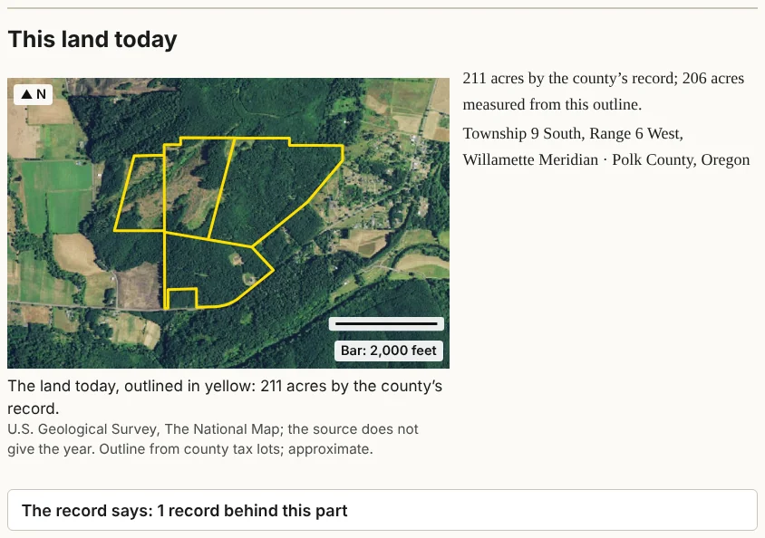
The first part, "This land today," is the land as it is now: the outline on an air photo, with a north arrow and a scale bar; the acres, both the county's figure and the figure measured from the outline; the township and range; and the county. When the records give it, the range of elevation is shown too. A fact the site could not find is simply left out.
The caption reads "The land today, outlined in yellow: [number] acres," with the photo's source and year, or "the source does not give the year," and the word "approximate," because outlines are drawn from map layers, not from a survey on the ground.
In the sample report
The sample's opening names John Johnson, who received a patent for 323.521 acres on June 14, 1877, under the Oregon Donation Act, for Donation Land Claim 53, in parts of Sections 27, 28, 33 and 34. It adds that the surveyors' notes list 23 trees at 13 corners, mostly oaks. Under the opening, a short note explains why this farm is the sample. "This land today" reads "211 acres by the county's record; 206 acres measured from this outline."1
Notes
- The sample report, October 10, 2026: the opening, from Bureau of Land Management, General Land Office Records, patent to John Johnson, June 14, 1877, 323.521 acres; "This land today," from Polk County tax lots. ↩