
Chapter 24. If you're hooked: what to do next
A few evenings with free records replaced a wrong story about the tree farm near Pedee with a documented one. They turned up a prairie, an oak woodland and two pioneer claims under a Douglas-fir plantation.1 Your land has a file like that one waiting. Here is how to open it.
A plan for your first week
- Write down one question about your land (Chapter 2).
- Find your township, range and section, and your tax lot (Chapter 3).
- Look up your geology and your soils, and save both maps (Chapter 13).
- Download the first survey plat and the field notes for your section (Chapters 6 and 11).
- Find the earliest aerial photograph of your land (Chapter 12).
- Make a list of the people who know the place, and call the oldest one first (Chapter 18).
- Start your research log, and enter everything you have found (Chapter 19 and Figure 24.1).
That is enough to know whether you want to go further.
Let the site do the first hour
The website Your Land History, at YourLandHistory.org, gathers the survey plats, field notes, patents, soils, geology, rainfall and modern aerial photographs for a piece of Oregon land and writes them up in plain English (Chapter 5). Start there. Then spend your own evenings on what a computer cannot fetch.
Where the rest is kept
- The county clerk's deed index, for the owners between the patent and today (Chapter 8).
- The Bureau of Land Management, for survey records and patents not yet online, and the National Archives, for the files behind the patents (Chapter 7).
- The Oregon State Archives, for old tax rolls, road records and estate files (Chapter 25).
- Your county historical society and museum, for photographs, family files and the people who still know the old names.
- The cultural offices of the tribes, who are the authorities on their own history (Chapter 16).
- The offices and websites this guide uses most, with addresses and telephone numbers, are in Chapter 25.
Share what you learn, with care
Before you share anything, take out the locations of archaeological sites and burials, honor what each person you interviewed agreed to, and check the rights to every photograph (Chapter 19). Then share it. A copy of your timeline and your sources, given to the county historical society, saves the next researcher the evenings it cost you.
One request
If you try any part of this guide on your own land, send word of where it was unclear, where a link failed, or where your county's records work differently. One paragraph is plenty. Send corrections and additions through the Your Land History site: the About page, or the "That's wrong" link beside any record.
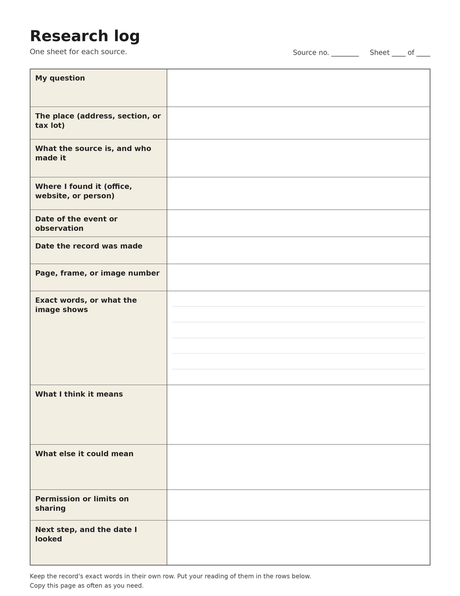
Figure 24.1. A research log form to copy. Use one copy for each source. Keep the record's exact words in their own row, and your reading of them in the rows below. Drawn for this guide.
On the tree farm
The farm's history ends the way this guide does, with a list of next steps: the claim files on FamilySearch, the deed books from 1877 on, the estate files of John Johnson and Charles Pagett, Pagett's homestead file, the 1934 drawings of the Johnson house, a walk to the old corners with the notes in hand, and a published account of the first people of the Luckiamute country. Its last lines make the same invitation this chapter makes. If you know these families, this land or these records, or have an old photograph of Pedee, the owner would like to hear from you.2 Send corrections and additions through the Your Land History site: the About page, or the "That's wrong" link beside any record.
Notes
- A History of the Land (2026), opening section and "December 1989 to today: becoming a tree farm."
- A History of the Land (2026), "Next steps for this property" and closing paragraphs.