
Chapter 10. Buildings, cemeteries and place names
In 1934 the Historic American Buildings Survey recorded the John Johnson house at Pedee in 16 drawings, which are now at the Oregon Historical Society.1 Johnson's donation claim reaches onto the Sullivan tree farm, and in 1855 a surveyor tied "Johnson's house" to a claim corner there. Whether the house drawn in 1934 is the house sighted in 1855, nobody knows yet. Johnson's claim reached into two other sections.2
Buildings, graves and names are records too. Each one was made by someone, at some date, and each can be found and read.
Buildings and house history
What it tells you. The records of a building tell when it went up, who built it, how it changed and who lived in it. For a house in town this is the main line of research.3
Where to find it.
- Sanborn fire insurance maps. Detailed maps of towns, made for insurance companies from the 1880s to the 1950s. They show each building's outline, height and material. The Library of Congress has many free online. They cover towns, not farms.3
- City directories. Yearly lists of residents by name and, in later years, by street address. Local libraries and museums hold them, and many are online.3
- The Oregon Historic Sites Database. Buildings that have been surveyed, listed by address, with an estimated date and style.4
- National Register of Historic Places nominations. If a building or its district is listed, the nomination file is a short researched history with its sources.3
- Drawings and photographs of rural buildings. Collections such as the Historic American Buildings Survey reached into the country, as the Johnson house shows. Search the Oregon Historical Society's catalog and Archives West (Chapter 25) by the family name and the community.
How to read it. On a fire insurance map, "Dwg" marks a dwelling, and the number inside the outline gives its stories (Figure 10.1).5 Lay two editions side by side. A change in a building's outline from one map to the next dates an addition.3
What it costs. The maps, the database and the nominations are free online. Collections in a research library cost a visit; admission to the Oregon Historical Society's research library is free.6
A caution. A date in an inventory or on a tax record is often an estimate. Check it against deeds, maps and photographs (Chapter 8).7
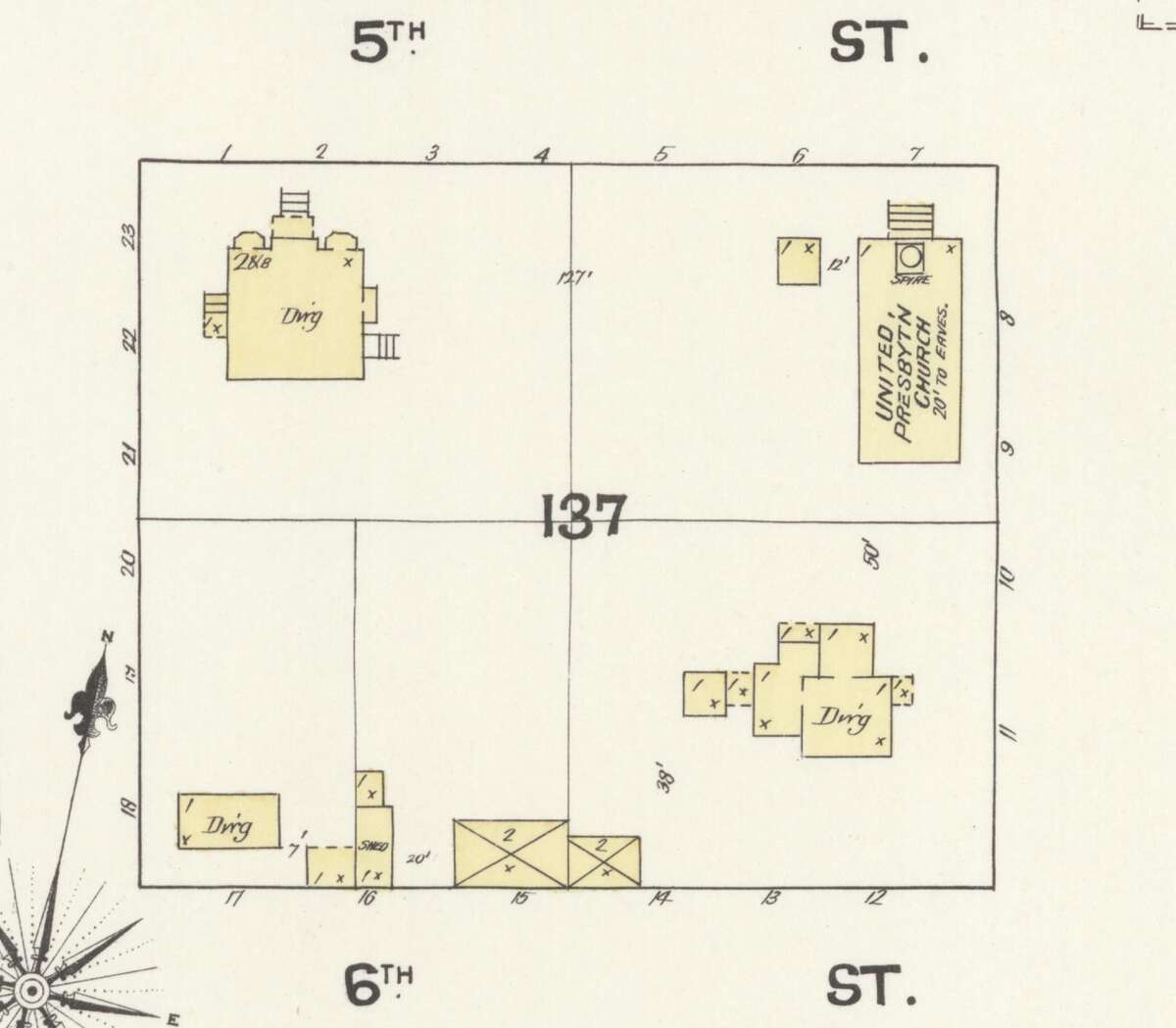
Figure 10.1. One block of Albany on the fire insurance map of 1890. Each building is drawn in outline. "Dwg" marks a dwelling, and the number inside gives its stories. Find the same block on a later edition, and any change in an outline dates an addition. Sanborn Map Company, Albany, Oregon, 1890, sheet 8. Library of Congress. Public domain.
Cemeteries and burial places
What they tell you. Gravestones give names and dates, and family plots show who belonged together (Figure 10.2). Small family cemeteries on farms are common, and some are forgotten.8
Where to find them. Find a Grave is a free index of more than 265 million memorials, with photographs, made by volunteers since 1995. BillionGraves is another. Oregon's Historic Cemeteries Program keeps a list of historic cemeteries by county.9 Some counties also have volunteer groups that record their old cemeteries; Polk County's is one.10
How to read them. Copy every word on the stone, and photograph the stones on either side. A volunteer's transcription is a lead, not proof: check it against the stone itself, a death record or a newspaper notice.10
A caution. Visit a cemetery on someone else's land only with permission. If you believe there are burials on your own land, ask the Historic Cemeteries Program or the county before doing any work nearby. Native burial places are protected by law, and their locations are never published (Chapter 16).8
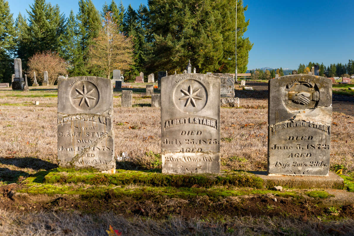
Figure 10.2. Headstones of the 1870s at Providence Cemetery, Linn County. A stone gives names and dates, and the stones around it show who was buried together. Gary Halvorson, Oregon State Archives. CC BY 4.0.
Place names and community places
The names of creeks, roads and crossroads are records too. Oregon Geographic Names explains thousands of them.11 Old schools, post offices, churches and granges mark where a neighborhood had its center, and their records name the families nearby (Figure 10.3).11
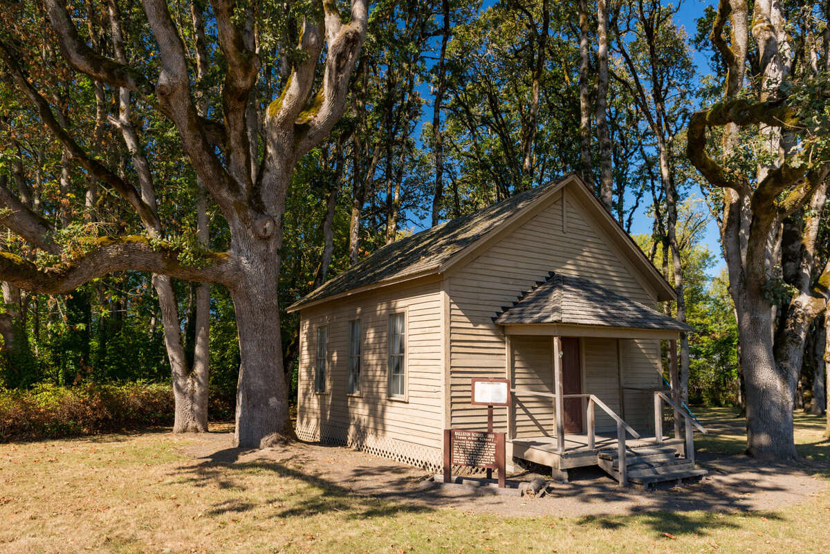
Figure 10.3. Ballston School, a one-room schoolhouse in Polk County, photographed in 2014. A rural school was the center of a neighborhood, and its records name the families who sent children there. Gary Halvorson, Oregon State Archives. CC BY 4.0.
On the tree farm
The name of the nearest town is a record in itself. Oregon Geographic Names says Pedee took its name from Pedee Creek, which Cornelius Gilliam or his family named for the Pee Dee River of the Carolinas.12 The name turns up in the farm's survey notes too. In 1854 Murphy's dooryard post stood beside "Mrs Gillam's dwelling," and in 1855 Hutchinson surveyed Mary Gilliam's claim.13 Whether she belonged to the family that named the creek, the records gathered so far do not say. Two graves tie families to the farm. John and Phebe Johnson share a monument in Taylor Cemetery, about half a mile southwest of the Pedee store. A Charles W. Pagett (1841 to 1905) is buried in Montgomery Cemetery, just southwest of Pedee, and he is likely, though not proven, to be the man who homesteaded the farm's north strip.14 On the east side of the farm stood a dirt-floored dwelling of about the 1930s. It had collapsed by 1990 and is now lost under blackberry. Who built it and who lived there, the records found so far do not say.15
Notes
- Oregon Historical Society Research Library, Mss 3100, John Johnson residence plans (1934), catalog entry; A History of the Land (2026), "The twentieth century, seen from the air" and annotated bibliography. The catalog entry has been read, not the drawings.
- Hutchinson (1855), vol. D0022; A History of the Land (2026), "1855: Two claims and two houses" and "The twentieth century, seen from the air."
- Zybach, B., How to Research Your Land's History, review draft, October 7, 2026, "Buildings and house history."
- Oregon Parks and Recreation Department, State Historic Preservation Office, Oregon Historic Sites Database, checked October 10, 2026; Zybach, review draft, "Buildings and house history."
- Sanborn Map Company, Albany, Oregon, 1890, sheet 8, Library of Congress; Zybach, review draft, Figure 10.
- Oregon Historical Society, Research Library web page, checked October 10, 2026.
- Zybach, review draft, "Tax lots and assessor records."
- Zybach, review draft, "Cemeteries and burial places."
- Find a Grave, site text, checked October 10, 2026; Oregon Parks and Recreation Department, Oregon Historic Cemeteries Program, checked October 10, 2026; Zybach, review draft, "Cemeteries and burial places."
- A History of the Land (2026), "Researching your own land's history," step 8, and annotated bibliography, entry for Polk County Pioneer Cemeteries.
- Zybach, review draft, "Place names and community places."
- Lewis A. McArthur, Oregon Geographic Names (1952 edition), "Pedee," as given in Zybach, review draft, "Place names and community places."
- Murphy (1854), vol. R0029, as read in A History of the Land (2026), "1852 to 1854"; Hutchinson (1855), vol. D0022, survey of the Mary Gilliam claim, July 13 to 14, 1855, as listed in A History of the Land (2026), "1855: Two claims and two houses."
- Polk County Pioneer Cemeteries, Taylor and Montgomery cemetery records, as read in A History of the Land (2026), "The Johnsons" and "1871 to 1900."
- A History of the Land (2026), "The twentieth century, seen from the air."