
Chapter 10. The surveyors arrive
Part 2. Reading your report.
This is often the richest part of a report. Starting in the 1850s, government surveyors walked the section lines with a compass and a chain, and wrote down what they saw: trees, prairies, creeks, fences and houses.
What it says. The date of the first survey map and the surveyors who did the work; the trees they marked at your land's corners; at Deep, every survey map and field-note book for the township.
Where the facts come from. The Bureau of Land Management's Oregon land records: the township plats (the survey maps) and the surveyors' field notes, scanned from the original books.
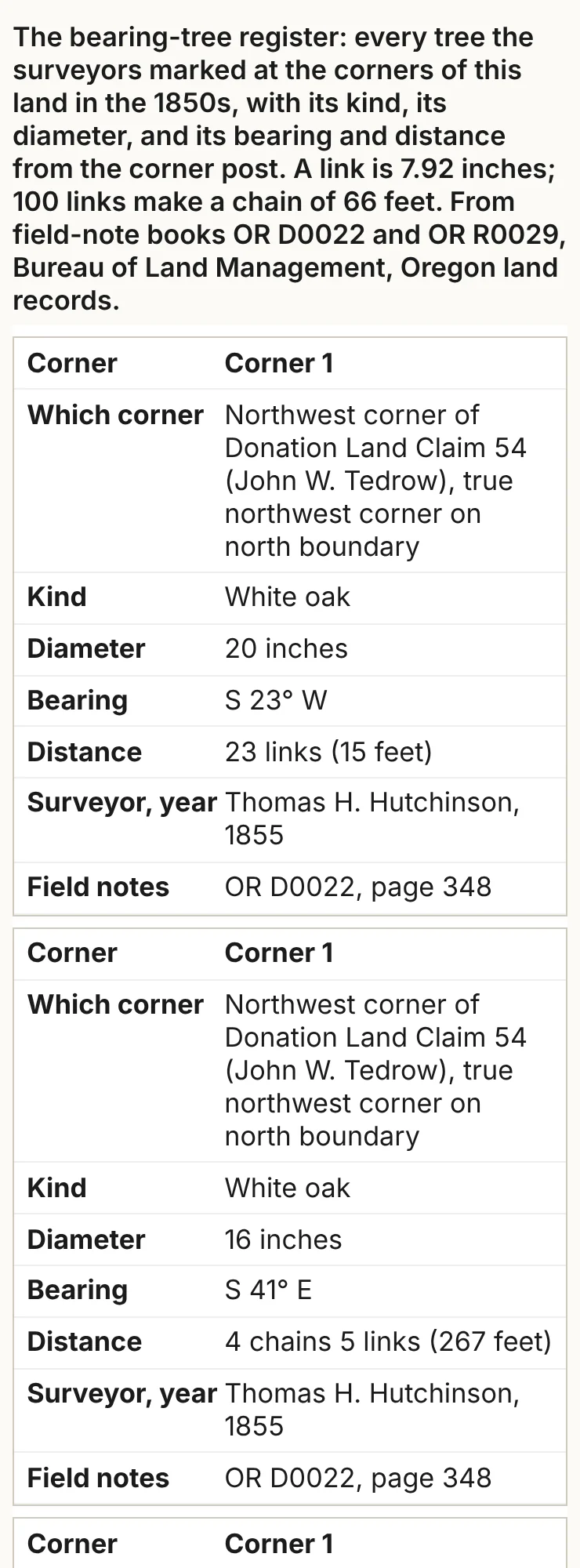
How to read the old units. The surveyors' chain was 66 feet long, made of 100 links; a link is just under 8 inches, and 80 chains make a mile. The report gives feet beside every chain and link. A bearing such as "S 23° W" means: face south, then turn 23 degrees toward the west. At each corner the surveyor set a post and recorded nearby trees, each with its kind, width, bearing and distance. Those are the bearing trees, also called witness trees: find the tree and you can find the corner. The surveyors' "red fir" is Douglas-fir.
The pictures.
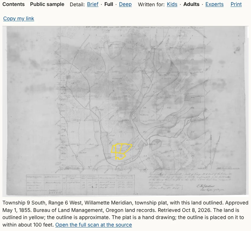
- The township plat, the hand-drawn map made from the notes, with your land outlined and a note on how closely, such as "to within about 100 feet."
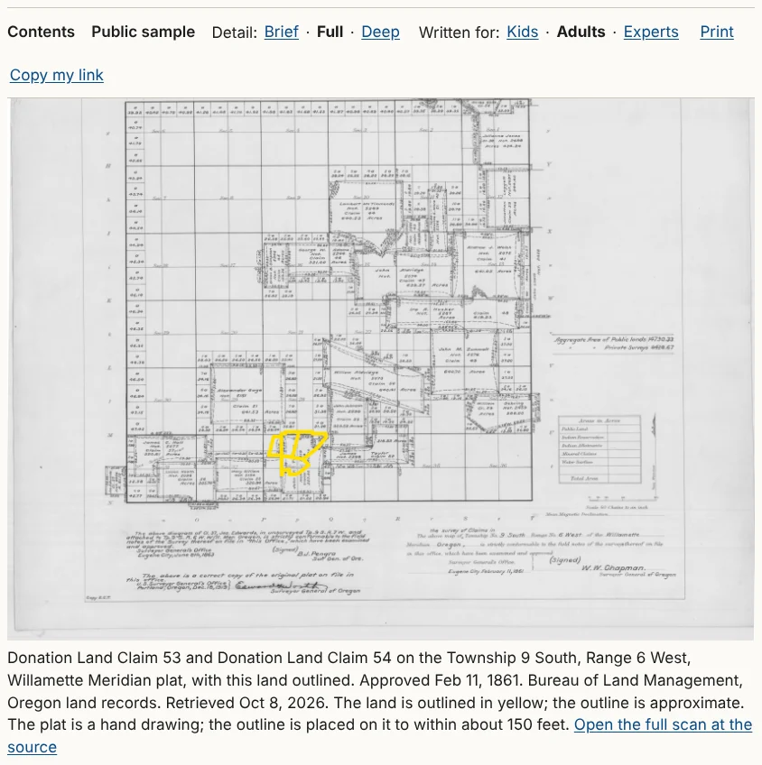
- The claim plat, where the land was a pioneer's claim, showing each claim's owner and number.
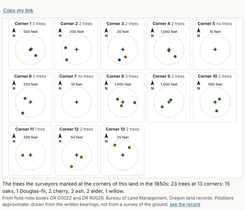
- The corner map, one small panel for each corner, north up, with the post at the center and each tree as a colored dot. Each panel has its own scale, read on its ring.
- The register, a table of every bearing tree: the corner, which corner it is, the kind of tree, its diameter, bearing and distance, the surveyor and year, and the field-note book and page. The entries were typed from the surveyors' handwriting by machine and not yet checked by a person; the appendix's "How sure we are" says so once for the whole report. On a phone each row becomes a card.
In the sample report
The township's first plat is dated May 1, 1855, drawn from Daniel Murphy's notes of 1854. Thomas H. Hutchinson surveyed the two land claims, Donation Land Claims 53 and 54; his notes date the survey of Claim 54, the Tedrow claim, to August 10 and 11, 1855. The corner map's caption tells the farm's oldest story in one line: 23 trees at 13 corners, 15 of them oaks and only one a Douglas-fir.1
Notes
- The sample report, "The surveyors arrive" and its corner map, from BLM Oregon land records: township plat approved May 1, 1855; Daniel Murphy, field notes, 1854, book R0029; Hutchinson (1855), book D0022, pages 347 to 351. ↩