50 States, 50 Places & 50 Stories › Virginia
Virginia sample place
McCormick Farm (VA Tech Research Center) & 1736 *Beverley Manor
Parcel at a glance
The Cyrus McCormick Farm (Shenandoah Valley Agricultural Research and Extension Center) sits at Walnut Grove along Marl Creek near Steele's Tavern on the border of Augusta and Rockingham Counties, inside the 1736 Beverley Manor Royal Patent. Owned today by Virginia Tech as a 600-plus-acre public research farm and historic mill complex, the tract preserves the 1831 mechanical reaper workshop alongside a 290-year Shenandoah Valley deed chain.
The land before the survey
For thousands of years before colonial entry, the Shenandoah Valley floor between the Blue Ridge and Allegheny Mountains was a primary hunting ground and travel corridor (the Great Indian Road, later the Great Wagon Road) of the Shawnee, Monacan, Tuscarora, and Haudenosaunee Nations. As the oldest English colony in America, Virginia has no federal rectangular survey grid. Instead, colonial titles originated through Royal Crown Headright Patents (granting 50 acres per person transported into the colony starting in 1619), Lord Fairfax's Northern Neck Proprietary grants to the north, and large 18th-century Valley settlement patents.
First owners and the paper trail
On September 6, 1736, King George II and Royal Governor William Gooch granted William Beverley and partners the 118,491-acre Beverley Manor Patent in the upper Shenandoah Valley to settle Ulster Scots (Scotch-Irish) and German families. Beverley's surveyors laid out irregular metes-and-bounds farms along the limestone springs and creeks, transferring title using the classic English Lease and Release two-deed mechanism (recording a nominal one-year lease on one day and a full fee-simple release the next day in the Augusta County Deed Books). In 1779, Revolutionary War veteran Robert McCormick Sr. bought the Walnut Grove farmstead, where his son Cyrus Hall McCormick invented and publicly demonstrated the mechanical grain reaper in July 1831 before descendants donated the farm to Virginia Tech in 1954.
School-trust connection
Virginia holds a foundational double place in American school-trust history. First, Virginia's 1784 Cession of the Northwest Territory created the Federal Public Domain where the 1785 Section 16 school compact was born. Second, because Virginia had no Section 16s inside its own borders, the General Assembly created the Virginia Literary Fund in 1810—dedicating all escheated, forfeited, delinquent, and unappropriated waste lands across the Commonwealth as a permanent fund to support schooling for poor children (the Literary Fund received constitutional protection only in later constitutions).
What records survive and where to look
- Free Online Patents & Chancery Plats: The Library of Virginia (LVA) Land Office database provides 100% free online scans of all Crown and Commonwealth Patents (1623–1992), while LVA's Chancery Records Index hosts scanned 18th- and 19th-century estate partition plats.
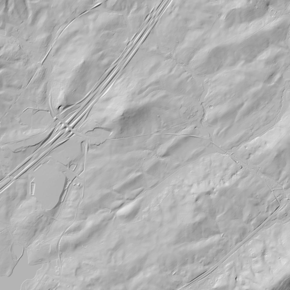
- Unburned County Deeds & Lidar: Augusta County escaped Civil War courthouse destruction, and its complete Deed Books, Will Books, and Surveyor Plat Books back to 1745 are digitized on FamilySearch alongside statewide VGIN parcel GIS and 1-meter lidar.
What we are still confirming
- The exact Augusta County Deed Book and Page numbers for the initial 1740s William Beverley Lease-and-Release conveyance of the Marl Creek mill seat prior to Robert McCormick's 1779 purchase.
Historical & landscape images
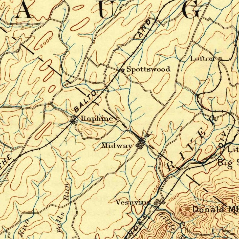
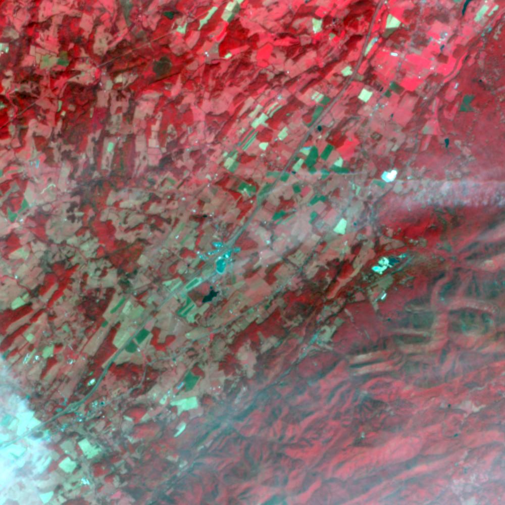
Aerial photographs, historical topographic surveys, lidar elevation, and ground imagery gathered for this place.
How to get more images
- USGS EarthExplorer (earthexplorer.usgs.gov, free account): Aerial Photo Single Frames, NHAP (1980–89, incl. color-infrared) and NAPP (1987–2007) covering this site. Medium-resolution scans download free; high-resolution film scans cost about $30 per frame (2–3 weeks).
- USDA FSA Aerial Photography Field Office (APFO, Salt Lake City): historic county-wide farm-program photos from the 1930s on, ordered by email/phone; scans run roughly $20–$50 per frame (check current price list).
- National Archives (College Park, Cartographic Branch): 1930s–1950s USDA/AAA aerials; free to view in person, reproductions through NARA's order service or approved vendors.
- the Virginia State Archives / state historical society and the state university map library (ask about historic aerial prints and scans); the state GIS clearinghouse for lidar.
- HistoricAerials.com (NETR Online): stitched historic aerials and topos by address; downloads/prints priced per image (often about $30–$80 for personal use; commercial licensing extra).
- Commercial satellite (Maxar/Vantor, Airbus, Planet via resellers such as SkyWatch or Apollo Mapping): archive scenes from ~$10–$25/km² with small minimum orders; new tasking costs more.
- Drone flight: a local FAA Part 107 pilot typically charges about $200–$600 for a basic photo/video shoot of a parcel; ask the landowner or site manager for permission first.
This sample report was researched from public records and checked against its sources. Historical research, not title or boundary advice.
← All 50 states, places & stories · Original 50 Picks Archive · Start your own Land File