50 States, 50 Places & 50 Stories › Rhode Island
Rhode Island sample place
Casey Farm & 1657 Pettacomscott Purchase School Reserve
Parcel at a glance
Historic Casey Farm and the adjoining Kingston Hill uplands sit on a coastal neck between Narragansett Bay (West Passage) and Narrow River (Pettaquamscutt) in Washington County (Towns of North Kingstown and South Kingstown), inside the 1657/1658 Pettacomscott Purchase. Owned and operated as a 300-acre working museum farm and woodland by the nonprofit Historic New England, this property has remained in continuous agricultural tenure for over 365 years and borders one of the oldest reserved school tracts in North America.
The land before the survey
For thousands of years before English settlement, the fertile coastal plain and salt ponds of southern Rhode Island ("The Narragansett Country") were the heartland of the Narragansett people. Because Rhode Island was founded by religious dissenters without a royal land office or federal survey grid, its earliest written land titles begin directly with 17th-century Native Sachem Deeds negotiated between Narragansett Sachems and syndicates of colonial Town Proprietors.
First owners and the paper trail
In January 1657/1658, a syndicate of seven Newport and Portsmouth proprietors negotiated the Pettacomscott Purchase with Narragansett Sachems ([TO CONFIRM]: sachem names). The proprietors surveyed long rectangular division strips running from the Narrow River salt marshes over Boston Neck and Kingston Hill, bounded by stone walls built by enslaved African, Indigenous, and indentured laborers on the large "Narragansett Planter" livestock estates of the 1700s. Acquired by the Casey family in the 18th century ([TO CONFIRM]: first Casey owner and date), Casey Farm remained in the same family—with every lease, farm account, and estate division preserved—until the last private owner bequeathed the 300-acre farm to the Society for the Preservation of New England Antiquities (now Historic New England) in 1955.
School-trust connection
When the seven Pettacomscott Proprietors met in 1657–1668 to divide their purchase into numbered proprietary lots, they set aside a 300-acre ministerial tract ([TO CONFIRM]: size, location and date), and in 1695 Judge Samuel Sewall, an heir of proprietor John Hull, gave land in the purchase to support a school ([TO CONFIRM]: deed details)—both more than a century before the Land Ordinance of 1785. Statewide, Rhode Island created its Permanent School Fund in 1828.
What records survive and where to look
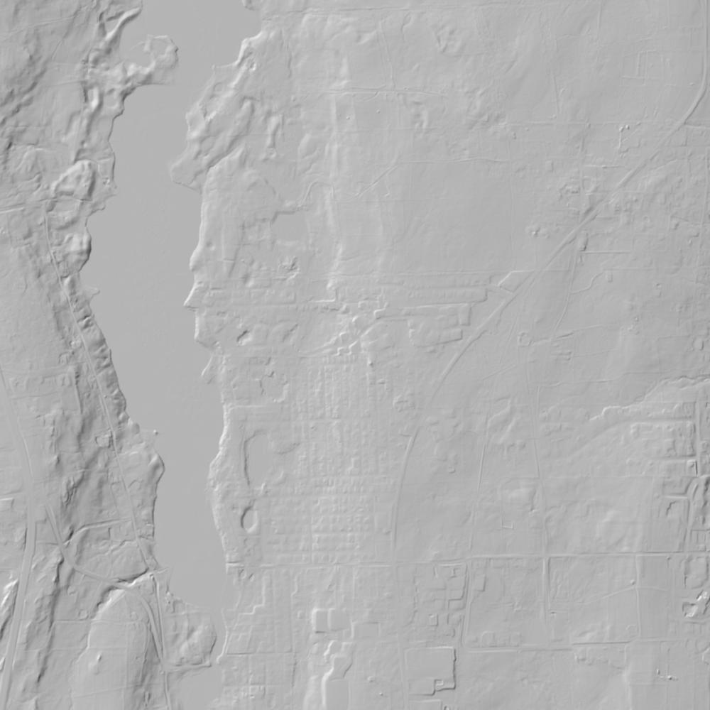
- 1939 Post-Hurricane Aerials & Stone-Wall Lidar: RIGIS provides free statewide parcel polygons, 1939 statewide aerial photography (showing the dramatic timber blowdowns immediately after the Great Hurricane of 1938), and 1-meter bare-earth lidar revealing the intact 17th- and 18th-century stone-wall grid.
- Town Land Evidence & Family Papers: Because Rhode Island records deeds in its 39 individual Cities and Towns, South Kingstown and North Kingstown Town Land Evidence Books back to 1692 are digitized on FamilySearch, supplemented by the Casey Family Papers at Historic New England and the 1657 Proprietors' records at the Rhode Island Historical Society.
What we are still confirming
- We are cross-checking the Casey family's private parchment deeds at Historic New England against the town Land Evidence books for 18th-century boundary descriptions ([TO CONFIRM]: any damage to North Kingstown's early volumes).
Historical & landscape images
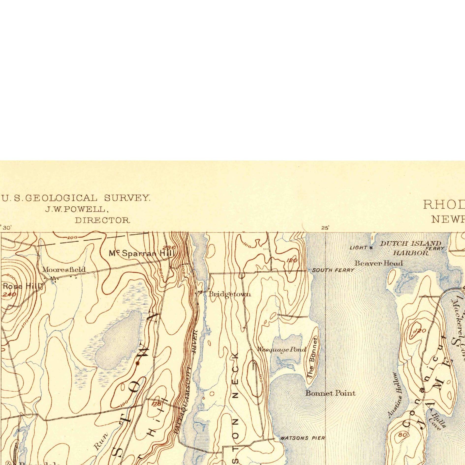
Aerial photographs, historical topographic surveys, lidar elevation, and ground imagery gathered for this place.
How to get more images
- USGS EarthExplorer (earthexplorer.usgs.gov, free account): Aerial Photo Single Frames, NHAP (1980–89, incl. color-infrared) and NAPP (1987–2007) covering this site. Medium-resolution scans download free; high-resolution film scans cost about $30 per frame (2–3 weeks).
- USDA FSA Aerial Photography Field Office (APFO, Salt Lake City): historic county-wide farm-program photos from the 1930s on, ordered by email/phone; scans run roughly $20–$50 per frame (check current price list).
- National Archives (College Park, Cartographic Branch): 1930s–1950s USDA/AAA aerials; free to view in person, reproductions through NARA's order service or approved vendors.
- the Rhode Island State Archives / state historical society and the state university map library (ask about historic aerial prints and scans); the state GIS clearinghouse for lidar.
- HistoricAerials.com (NETR Online): stitched historic aerials and topos by address; downloads/prints priced per image (often about $30–$80 for personal use; commercial licensing extra).
- Commercial satellite (Maxar/Vantor, Airbus, Planet via resellers such as SkyWatch or Apollo Mapping): archive scenes from ~$10–$25/km² with small minimum orders; new tasking costs more.
- Drone flight: a local FAA Part 107 pilot typically charges about $200–$600 for a basic photo/video shoot of a parcel; ask the landowner or site manager for permission first.
This sample report was researched from public records and checked against its sources. Historical research, not title or boundary advice.
← All 50 states, places & stories · Original 50 Picks Archive · Start your own Land File