50 States, 50 Places & 50 Stories › Kentucky
Kentucky sample place
McConnell Springs Historic Park (1779 Virginia Settlement)
Parcel at a glance
McConnell Springs Historic Park sits in a sunken limestone karst basin on the northwest side of Lexington in Fayette County, inside a 1779 Virginia Land Commission Settlement and Preemption Tract. Owned today by the Lexington-Fayette Urban County Government as a 26-acre public nature and history park, the tract preserves the natural artesian "blue hole" springs where Lexington was named in June 1775.
The land before the survey
For thousands of years, the Inner Bluegrass plain—underlain by soluble Ordovician limestone, sinking creeks, underground caves, and giant cane breaks—served as a prized hunting ground of the Shawnee, Cherokee, and Haudenosaunee Nations along the Great Warriors' Path. Carved out of Virginia in 1792, Kentucky has no federal rectangular survey grid outside its far-western Jackson Purchase. Instead, titles across central and eastern Kentucky began with Virginia military and treasury warrants surveyed by irregular metes and bounds.
First owners and the paper trail
In June 1775, woodsman William McConnell and a party of frontier explorers camped at this sinking spring, built a log cabin improvement, and named their camp "Lexington" upon hearing news of the opening battle of the Revolutionary War in Massachusetts. Under the Virginia Land Law of May 1779, a special Virginia Land Commission met at Bryan's Station and Harrodsburg in 1779–1780 and issued settlement and preemption rights around the spring ([TO CONFIRM]: McConnell's certificate acreages, often given as 400 acres plus a 1,000-acre preemption). That certificate launched Virginia's classic four-step paper trail: Warrant $\rightarrow$ County Surveyor's Entry $\rightarrow$ Metes-and-Bounds Survey Plat (calling out sugar trees, blue ash, buckeyes, and cane) $\rightarrow$ Sovereign Patent. Because competing claimants staked overlapping "shingle" surveys across the Bluegrass, early Fayette County equity courts spent decades untangling boundary lines before the spring tract passed through 19th-century gunpowder mill, distillery, and dairy-farm uses (bounded by hand-laid limestone rock fences) and became a public park in the 1990s.
School-trust connection
Because Virginia warrants consumed Kentucky's prime Bluegrass land before 1792 statehood, Kentucky received no federal Section 16 school lands. To create a public education endowment, the General Assembly enacted the 1798 Kentucky County Seminary Act—granting 6,000 acres of vacant state land per county to endow local academies (including Transylvania Seminary in Lexington)([TO CONFIRM]: any later county land warrants for common schools).
What records survive and where to look
- Free online Virginia & Kentucky patents: The Kentucky Secretary of State Land Office portal provides 100% free online scans of every Virginia and Old Kentucky Warrant, original handwritten Surveyor's Plat, Patent, and County Seminary Grant.
- County deeds, Burned Records & lidar: Fayette County PVA GIS and statewide KyFromAbove 2-foot lidar are open online, while FamilySearch hosts Fayette County deeds back to 1794 plus the transcribed "Burned Records" volumes where pioneers re-recorded pre-1803 deeds after a clerk's office fire.
What we are still confirming
- The exact Virginia Patent Book and Page citation and early Fayette Circuit Court boundary decree resolving the overlap between William McConnell's 1779 Settlement/Preemption survey and adjoining military warrants.
Historical & landscape images
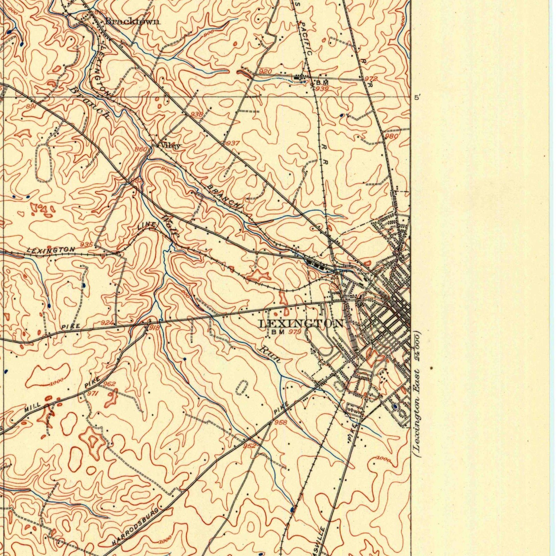
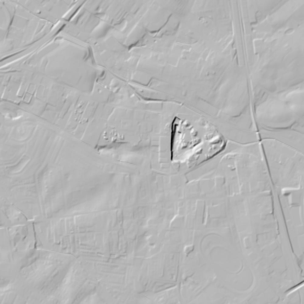
Aerial photographs, historical topographic surveys, lidar elevation, and ground imagery gathered for this place.

How to get more images
- USGS EarthExplorer (earthexplorer.usgs.gov, free account): Aerial Photo Single Frames, NHAP (1980–89, incl. color-infrared) and NAPP (1987–2007) covering this site. Medium-resolution scans download free; high-resolution film scans cost about $30 per frame (2–3 weeks).
- USDA FSA Aerial Photography Field Office (APFO, Salt Lake City): historic county-wide farm-program photos from the 1930s on, ordered by email/phone; scans run roughly $20–$50 per frame (check current price list).
- National Archives (College Park, Cartographic Branch): 1930s–1950s USDA/AAA aerials; free to view in person, reproductions through NARA's order service or approved vendors.
- KYAPED / KyFromAbove (free statewide lidar and imagery) and UK Libraries.
- HistoricAerials.com (NETR Online): stitched historic aerials and topos by address; downloads/prints priced per image (often about $30–$80 for personal use; commercial licensing extra).
- Commercial satellite (Maxar/Vantor, Airbus, Planet via resellers such as SkyWatch or Apollo Mapping): archive scenes from ~$10–$25/km² with small minimum orders; new tasking costs more.
- Drone flight: a local FAA Part 107 pilot typically charges about $200–$600 for a basic photo/video shoot of a parcel; ask the landowner or site manager for permission first.
This sample report was researched from public records and checked against its sources. Historical research, not title or boundary advice.
← All 50 states, places & stories · Original 50 Picks Archive · Start your own Land File