50 States, 50 Places & 50 Stories › Connecticut
Connecticut sample place
Beckley Furnace & Mount Riga Iron/Charcoal Proprietors' Tract
Parcel at a glance
The Beckley Furnace State Industrial Monument and the adjoining Mount Riga iron-and-charcoal tracts sit along the Blackberry River and the Taconic plateau in Litchfield County (Towns of North Canaan and Salisbury), inside 1730s Town Proprietors' Pitches. Owned today by the State of Connecticut and local conservation trusts, this multi-lot waterpower and mountain woodlot corridor preserves an 1847 stone blast furnace surrounded by forest hillsides still dimpled with hundreds of colonial and 19th-century charcoal hearths.
The land before the survey
Before European settlement, the Housatonic and Blackberry River valleys were the homeland of the Mahican (Mohican) and Schaghticoke peoples, who traveled the river corridors and knew the rich limonite iron-ore beds at Ore Hill in Salisbury. As one of the original thirteen colonies, Connecticut has no federal rectangular survey grid. Instead, in the 1730s the Connecticut General Assembly auctioned off the "Western Lands" townships, and syndicates of Town Proprietors surveyed Salisbury and Canaan into numbered "Divisions" and "Pitches" using metes-and-bounds calls measured in rods, links, and heaps of stones.
First owners and the paper trail
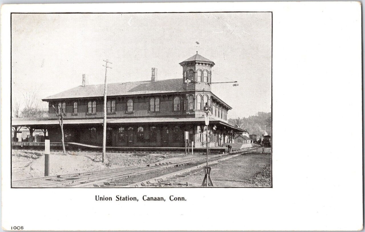
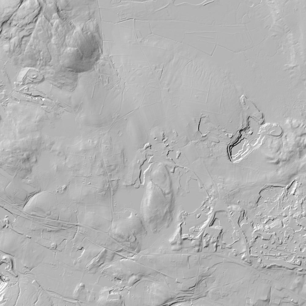
From the 1730s onward, proprietors pitched waterpower lots along the falls of the Blackberry River and laid out woodlots up the slopes of Canaan Mountain and Mount Riga. In 1847, ironmaster John Adam Beckley built the 40-foot stone blast furnace at the river falls to smelt Salisbury iron ore into prized railroad car-wheel iron. Because smelting required vast amounts of charcoal, the iron companies bought up thousands of acres of mountain woodlots, where teams of colliers leveled circular 30-foot earthen platforms ("charcoal hearths") to slow-burn oak and chestnut cordwood—features that stand out clearly today on 1-meter bare-earth lidar. After the furnace closed in 1919, the State of Connecticut acquired the furnace parcel in 1946.
School-trust connection
In the 1730s town charters of Salisbury and Canaan, the Proprietors reserved dedicated shares for the Ministry and for Town Schools. On a statewide scale, Connecticut built its permanent 1795 Connecticut School Fund by selling its 3-million-acre "Western Reserve" on the south shore of Lake Erie in Ohio for $1.2 million—and then invested that endowment by issuing interest-bearing farm mortgages recorded directly in local Connecticut Town Land Records.
What records survive and where to look
- Town Land Records: Because Connecticut records deeds in its 169 individual Towns rather than by county, the complete Town Land Records and Proprietors' Pitch Books of Salisbury and Canaan/North Canaan from the 1730s to the 1900s are digitized on FamilySearch.
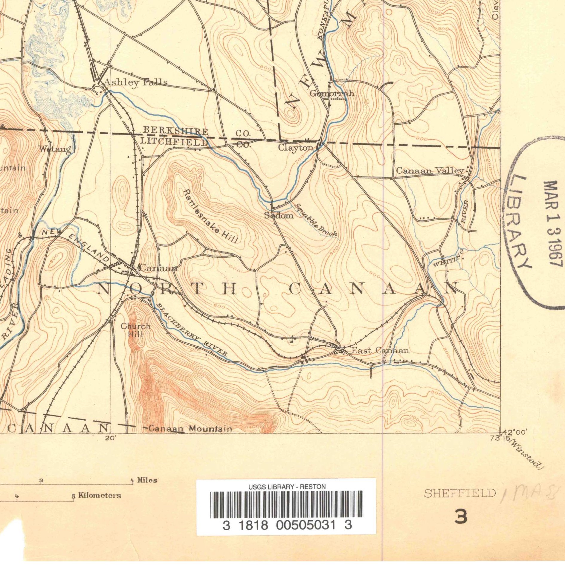
- Aerials & lidar: UConn's MAGIC portal hosts the 1934 Fairchild Statewide Aerial Survey (the first statewide aerial survey in America), and CT ECO provides statewide parcel GIS and 1-meter lidar revealing stone walls and charcoal hearths.
What we are still confirming
- The exact volume and page in the colonial Canaan Proprietors' Book for the initial 18th-century waterpower pitch at the Blackberry River falls.
- Whether any 19th-century Connecticut School Fund mortgage deeds were recorded on the adjoining Beckley furnace woodlots.
Historical & landscape images
Aerial photographs, historical topographic surveys, lidar elevation, and ground imagery gathered for this place.

How to get more images
- USGS EarthExplorer (earthexplorer.usgs.gov, free account): Aerial Photo Single Frames, NHAP (1980–89, incl. color-infrared) and NAPP (1987–2007) covering this site. Medium-resolution scans download free; high-resolution film scans cost about $30 per frame (2–3 weeks).
- USDA FSA Aerial Photography Field Office (APFO, Salt Lake City): historic county-wide farm-program photos from the 1930s on, ordered by email/phone; scans run roughly $20–$50 per frame (check current price list).
- National Archives (College Park, Cartographic Branch): 1930s–1950s USDA/AAA aerials; free to view in person, reproductions through NARA's order service or approved vendors.
- CT State Library and UConn MAGIC historic aerials (1934 statewide flight, free online).
- HistoricAerials.com (NETR Online): stitched historic aerials and topos by address; downloads/prints priced per image (often about $30–$80 for personal use; commercial licensing extra).
- Commercial satellite (Maxar/Vantor, Airbus, Planet via resellers such as SkyWatch or Apollo Mapping): archive scenes from ~$10–$25/km² with small minimum orders; new tasking costs more.
- Drone flight: a local FAA Part 107 pilot typically charges about $200–$600 for a basic photo/video shoot of a parcel; ask the landowner or site manager for permission first.
This sample report was researched from public records and checked against its sources. Historical research, not title or boundary advice.
← All 50 states, places & stories · Original 50 Picks Archive · Start your own Land File