50 States, 50 Places & 50 Stories › Colorado
Colorado sample place
Walker / Heil Valley Ranch Open Space & Left Hand Ditch Tract
Parcel at a glance
The Walker and Heil Valley Ranch Open Space corridor sits along the Dakota Hogback and Left Hand Creek north of Boulder in Boulder County, Township 2 North, Range 70 West and Range 71 West, Sections 16 and 21, Sixth Principal Meridian. Spanning steep pine-covered sandstone ridges and grassy foothill valleys between 5,500 and 7,000 feet of elevation, the property is public open space owned and managed by Boulder County Parks & Open Space.
The land before the survey
For generations before American gold seekers arrived in 1858–1859, the sheltered valleys where Front Range streams break through the hogback ridges were favored winter camps and hunting grounds of the Hinono'eino (Southern Arapaho) and Tsitsistas (Southern Cheyenne) peoples, alongside seasonal Ute trails into the high country. Following the contested 1861 Treaty of Fort Wise, federal deputy surveyors extended the Sixth Principal Meridian across the Boulder Valley in the early 1860s, noting the dramatic upturned red Lyons Sandstone and Dakota Hogback ledges that formed natural livestock fences.
First owners and the paper trail
In the 1860s and 1870s, pioneer ranchers and quarrymen filed federal Preemption and Homestead entries along the creek bottoms and spring gulches at the foot of the hogback. Because semi-arid foothill pastures depended entirely on creek water, early settlers dug pioneer irrigation ditches out of Left Hand and St. Vrain Creeks, establishing early priority dates adjudicated by the Boulder County District Court in Water District #5 under the "Colorado Doctrine" of pure prior appropriation. Over the 20th century, ranching families—including the Heil family ([TO CONFIRM]: ranching, logging and quarry history)—consolidated the homesteads into a working mountain ranch before conveying the nearly 5,000-acre holding to Boulder County Parks & Open Space beginning in the 1990s.
School-trust connection
Under Section 7 of the Colorado Enabling Act of March 3, 1875 (18 Stat. 474), Congress granted Sections 16 and 36 of every township to the State of Colorado for the support of common schools. Section 16 in this foothill corridor illustrates Colorado's classic split-estate trust model: even where the Colorado State Land Board sold or exchanged surface grazing lands into public open space, the State Land Board typically reserved the subsurface mineral estate ([TO CONFIRM]: reservation on this Section 16) to generate revenue for the Public School Fund.
What records survive and where to look
- County Recorder, Surveyor & Open Space files: Boulder County's online Assessor and Clerk/Recorder portal provides free scanned deed images back to the 1950s, recorded Surveyor Plats, and public Open Space acquisition files, while 1861–1920s deeds are digitized on FamilySearch.
- Water decrees & federal patents: The Colorado Division of Water Resources (CDSS / HydroBase) publishes complete Water District #5 court decrees and diversion logs, and the BLM GLO portal holds the 1860s survey field notes and homestead patents.
What we are still confirming
- The exact Water District #5 court decree priority number and appropriation date for the pioneer ditch lateral serving Section 21.
- The exact Colorado State Land Board patent number and mineral-reservation book and page for the surface transfer of adjoining Section 16.
Historical & landscape images
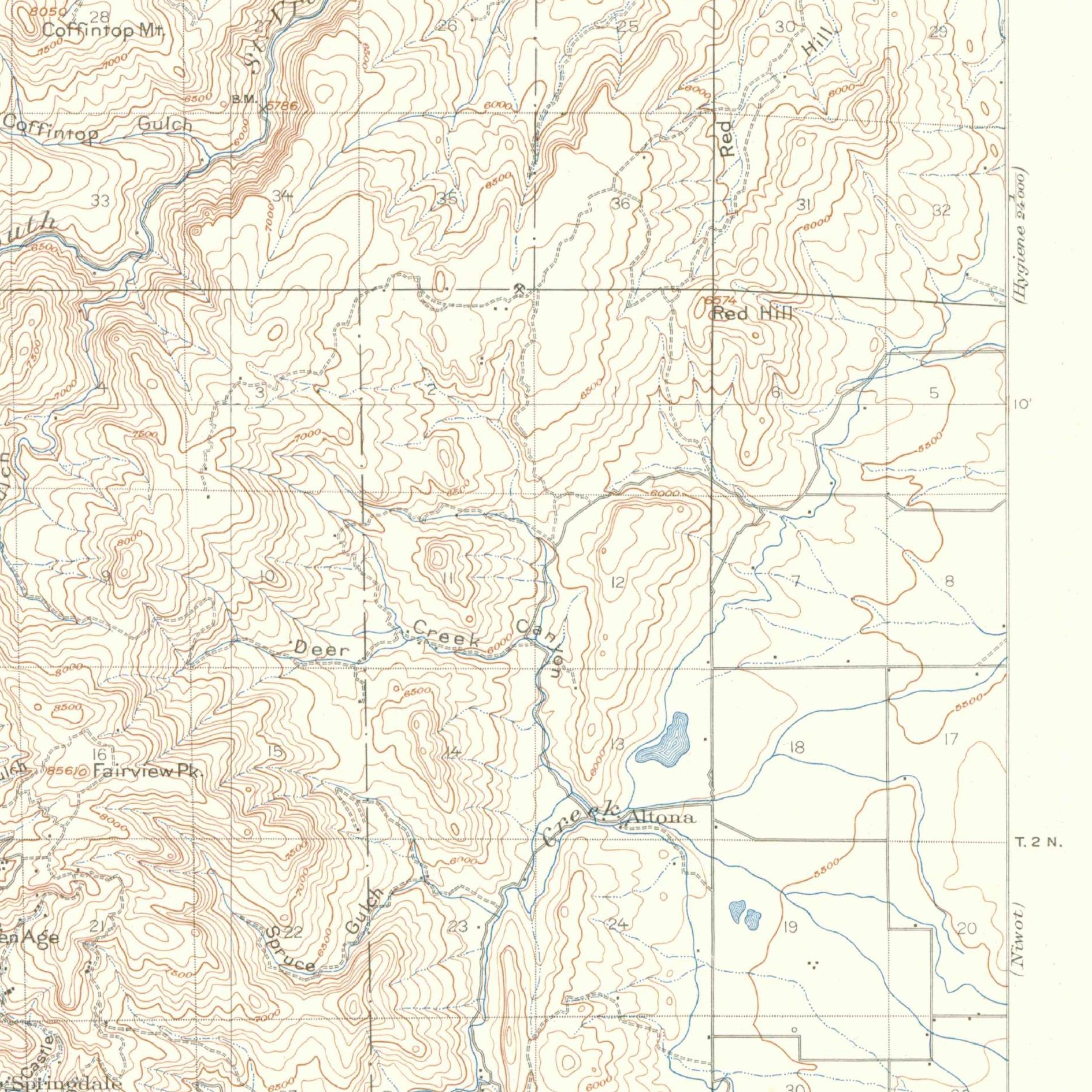
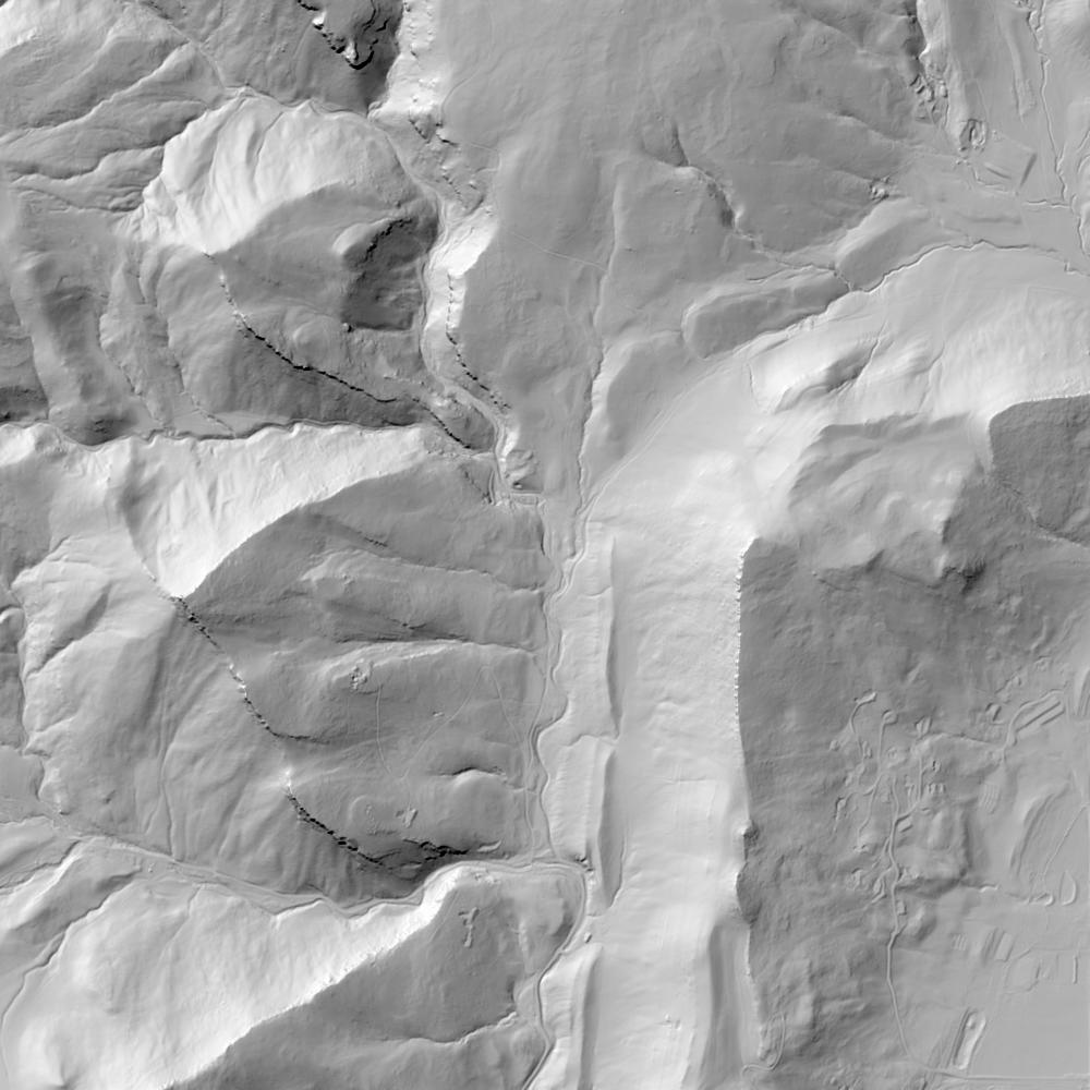
Aerial photographs, historical topographic surveys, lidar elevation, and ground imagery gathered for this place.

How to get more images
- USGS EarthExplorer (earthexplorer.usgs.gov, free account): Aerial Photo Single Frames, NHAP (1980–89, incl. color-infrared) and NAPP (1987–2007) covering this site. Medium-resolution scans download free; high-resolution film scans cost about $30 per frame (2–3 weeks).
- USDA FSA Aerial Photography Field Office (APFO, Salt Lake City): historic county-wide farm-program photos from the 1930s on, ordered by email/phone; scans run roughly $20–$50 per frame (check current price list).
- National Archives (College Park, Cartographic Branch): 1930s–1950s USDA/AAA aerials; free to view in person, reproductions through NARA's order service or approved vendors.
- the Colorado State Archives / state historical society and the state university map library (ask about historic aerial prints and scans); the state GIS clearinghouse for lidar.
- HistoricAerials.com (NETR Online): stitched historic aerials and topos by address; downloads/prints priced per image (often about $30–$80 for personal use; commercial licensing extra).
- Commercial satellite (Maxar/Vantor, Airbus, Planet via resellers such as SkyWatch or Apollo Mapping): archive scenes from ~$10–$25/km² with small minimum orders; new tasking costs more.
- Drone flight: a local FAA Part 107 pilot typically charges about $200–$600 for a basic photo/video shoot of a parcel; ask the landowner or site manager for permission first.
This sample report was researched from public records and checked against its sources. Historical research, not title or boundary advice.
← All 50 states, places & stories · Original 50 Picks Archive · Start your own Land File